Replace the desktop
Compare capabilities, move projects and prepare editors.

ArcGIS · QGIS · PostGIS · GeoServer · pygeoapi
Evaluate, implement and operate QGIS, PostGIS, GeoServer and pygeoapi. Practical guides, architecture decisions and transparent costs for migrating from ArcGIS or building a hybrid platform in Latin America.
GeoSAT · Public mapping
A GeoSAT application you can use now. MapLibre and public sources for exploring planning layers, comparing population, creating thematic maps and analyzing records in your browser. Free, without an account.
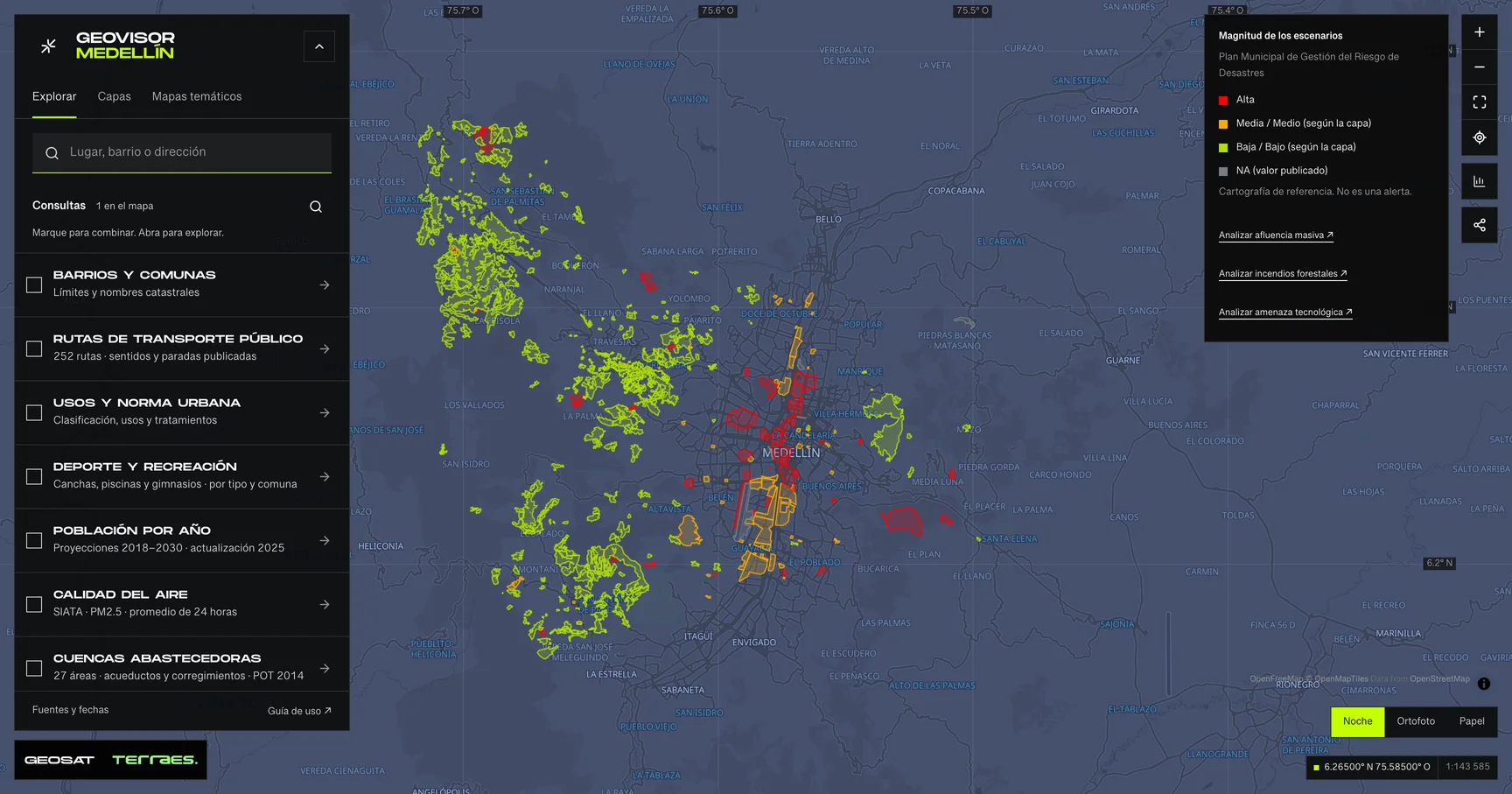
Geovisor view · Municipal Disaster Risk Management Plan scenarios, City of Medellín. Reference mapping: not alerts or events.
How to use itStart with data and desktop; progress to services and applications.
Compare capabilities and test the workflows your organization must preserve.
Calculate transition, operations and licensing using your own figures.
Six paths, from the initial decision to acceptance testing. Keep ArcGIS where it adds value and migrate the remaining steps gradually.
Compare capabilities, move projects and prepare editors.
Migrate geometries, permissions and rules; rehearse a restore.
Verify clients, styling, security and operational continuity.
Connect PostGIS, OGC API and a web map with verifiable contracts.
Test forms, attachments and conflicts before changing applications.
Compare platforms, model costs and decide what to migrate first.
46 of 46 resources
From a first map to a maintainable operation. Follow the desktop, data, service and field paths; validate each change with a small example before applying it to your organization.
QGIS
Prepare data, coordinates, styling and a verifiable output before moving an ArcGIS workflow to QGIS.
QGIS · GDAL · GeoPackage
Inventory domains, relationships, attachments and identifiers before converting a geodatabase.
QGIS
Test cartographic equivalence by scale and output; a similar-looking screen is not enough.
QGIS · Python
Rewrite automation around verifiable results, with explicit inputs, tolerances and errors.
QGIS · PostGIS
Combine forms, geometry checks and database constraints to keep data dependable.
QGIS
Prepare a repeatable installation and an upgrade process that preserves projects and automation.
PostGIS · QGIS
Build a cadastral pilot with stable keys, verifiable geometry and clear boundaries from a complete legal model.
PostGIS · GDAL
Separate import, quality checks and publication to avoid replacing valid tables with a defective load.
PostGIS · SQL
Use EXPLAIN, GiST and queries with correct units to evaluate a reproducible improvement.
PostGIS · PostgreSQL
Separate owners, editors and readers, and test conflicts before opening the database to multiple clients.
PostGIS · PostgreSQL
A backup is useful only if it can recover data, extensions, permissions and consumers within the required time.
PostGIS · QGIS · ArcGIS
Design a shared database without confusing SQL connectivity with editing or versioning equivalence.
GeoServer · PostGIS
Publish a PostGIS fixture through GeoServer WMS/WFS, verify identifiers and rendered output, and diagnose CRS, store and client failures.
GeoServer · ArcGIS
Separate maps, features, editing, tiles and geoprocessing before replacing an endpoint.
GeoServer · SLD
Define server-side symbols and labels and test their behavior by scale and density.
GeoServer · GeoWebCache
Design tile matrices, extents, zoom levels and invalidation before generating millions of tiles.
GeoServer · Security
Configure GeoServer access across roles, REST, proxy and caches, then test anonymous reads, private attributes and administrative endpoints.
GeoServer
Recover GeoServer data, styles and security together, rehearse upgrades and rollback, and diagnose rendering, database and cache incidents.
pygeoapi · OGC API
Build a pygeoapi 0.24 CSV endpoint with full configuration, OpenAPI and executable checks for collections, features and missing identifiers.
pygeoapi · PostGIS
Configure the pygeoapi PostgreSQL provider, stable feature IDs, bounded filters, pagination and CRS; distinguish read-only policy from provider capability.
pygeoapi · OGC API
Deploy pygeoapi behind a production server and proxy with explicit limits, identity boundaries, cache rules, recovery and failure checks.
OGC API · WFS · pygeoapi
A practical comparison for deciding when to retain WFS, when to publish OGC API Features, and how to transition without breaking existing consumers.
MapLibre · GeoJSON
A complete example with fictional data, no keys and no basemap dependency.
Leaflet · GeoJSON
A complete example with fictional data, no keys and no basemap dependency.
PMTiles · MapLibre
When to use a tile archive, how to check HTTP Range and where queries belong.
QField · QGIS
Steps for designing forms, identifiers, basemaps, packages and reconciliation before sending field teams to areas without continuous connectivity.
QField · PostGIS
Design and test the return path before replacing the collection workflow.
ArcGIS · MapLibre · QField · PostGIS
Break down viewers, dashboards and collection; identify what needs building and maintaining.
MapLibre · OpenLayers · PostGIS · GeoServer · pygeoapi
Modernize enterprise GIS with MapLibre, OpenLayers, PostGIS and open services. Inventory, data, permissions, design, costs and workflow-based transition.
Compare complete workflows: editing, publishing, permissions, support and operations. An alternative must meet your requirements, and retaining ArcGIS components can be the right decision.
ArcGIS · QGIS
Compare ArcGIS Pro and QGIS across editing, analysis, automation, cadastre, networks and support, with a ten-task pilot and transparent total-cost criteria.
ArcGIS Enterprise · PostGIS · GeoServer
Compare ArcGIS Enterprise with an open GIS stack across identity, editing, versioning, sharing, field apps, operations and the work each replacement requires.
ArcGIS Server · GeoServer
Map ArcGIS Server services to GeoServer WMS, WFS and WMTS; identify REST clients, editing and geoprocessing that require adaptation or retention.
ArcGIS Online · Open GIS
Compare ArcGIS Online, self-hosted GIS and managed open services across sharing, credits, field workflows, operating responsibility and total cost.
QField · ArcGIS Field Maps
Compare QField and ArcGIS Field Maps for offline forms, photos, related records, conflicts and recovery using the same two-crew pilot and cost per accepted inspection.
GeoServer · pygeoapi · QGIS Server
Choose GeoServer, pygeoapi or QGIS Server by protocol version, styling, editing and application contract, with a concrete selection matrix.
ArcGIS · VertiGIS · CARTO · SuperMap · MapLibre · PostGIS · GeoServer
Compare enterprise GIS, WebGIS, mapping APIs and open-source options by workflows, data portability, costs and migration scope. A guide for teams in Latin America.
Understand how components connect and which responsibilities remain with your team. Organizational examples distinguish documented open-source use from an assumed complete replacement of ArcGIS.
PostGIS · GeoServer · pygeoapi · ArcGIS
Two complete GIS architectures—one open and cloud-native, one centred on ArcGIS Enterprise 12.1—compared layer by layer and adapted to Colombia.
H3 · Apache Pinot
Understand Uber’s published H3/Pinot analytical workflow, its limits, and a practical path from PostGIS analysis to a larger event architecture.
OpenStreetMap · MapLibre
Trace Meta’s 2023 open basemap workflow, the 2024 Daylight sunset and the data, rendering and update responsibilities a LATAM team must own.
pygeoapi · WIS2 · OGC API
Explain how wis2box combines ingestion, storage, pygeoapi and notifications, and what a generic OGC API still needs for institutional exchange.
Read published experiences with their source, date and scope. License savings are not the same as net migration savings; each case retains its limitations and context.
QGIS · PostGIS · GeoServer · ArcGIS
A fictional organization, illustrative scope and a five-year calculation you can reproduce.
QField · PostGIS · ArcGIS
A fictional example where support, training and coexistence exceed license reductions.
Build a budget covering transition, training, operations and retained licenses. Use your own figures in the calculator and compare the result with the capabilities you need to preserve.
ArcGIS · QGIS · PostGIS
Calculate ArcGIS migration TCO with retained licenses, labor, overlap, annual cash flow and sensitivity, using reproducible COP examples.
ArcGIS · QGIS
Read sourced QGIS adoption and migration evidence from Dominican IGN, Cornare, St. Joseph County and Barrow without overstating savings.
ArcMap · ArcGIS Pro · QGIS
Plan after ArcMap’s March 1, 2026 retirement: inventory MXD, data and scripts, compare QGIS with ArcGIS Pro, and control coexistence.
ArcGIS · QGIS · PostGIS · GeoServer
Execute an ArcGIS migration through inventory, architecture, pilot, change reconciliation, cost review, reversible batches and measured retirement.
These are third-party experiences, not GeoSAT projects. Check the source and period for every result.
2021 Annual GIS Department Summary · 2021 report, issued January 7, 2022
Implementation of an Open Source solution for INSPIRE publishing services · Issued September 2011 and updated February 2012
Surrey Heath Borough Council adopt XMAP Cloud GIS · Case published August 19, 2020
QGIS at the Federal Department of Town and Country Planning · Case contributed in January 2012
Cornare 2024 Management Report · 2024 management report
QGIS in the governmental FOSSGIS stack of the Canton of Solothurn · Case contributed in May 2009