ARD Inc. · IGAC
Registry 2024 · 1 contractSerranía de Chiribiquete National Park
Cadastral formation for the Amazonian national park listed by UNESCO as a mixed World Heritage site, in Caquetá and Guaviare.
SERVICES PORTFOLIO · 2026 EDITION
Services, flagship projects, our own platforms and our track record in numbers. Maps built from official open data and figures taken from our registry of 166 projects.
Scroll horizontally to browse the pages.
SERVICES PORTFOLIO · 2026
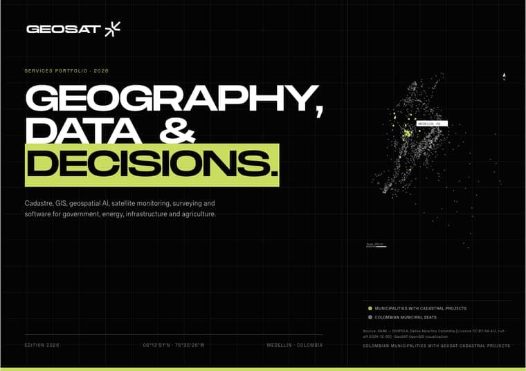
Cadastre, GIS, geospatial AI, satellite monitoring, surveying and software for government, energy, infrastructure and agriculture.
Colombian municipalities with GEOSAT cadastral projects
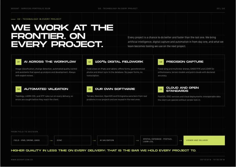
02 · TECHNOLOGY IN EVERY PROJECT
Every project is a chance to do better and faster than the last one. We bring artificial intelligence, digital capture and automation in from day one, and what we learn becomes tooling we use on the next project.
AI across the workflow
Image classification, change detection, automated quality control and assistants that speed up analysis and development. Always with expert review.
100% digital fieldwork
Field crews on iPads and tablets: offline forms, georeferenced photos and direct sync to the database. No paper forms, no transcription.
Precision capture
Fixed-wing and multirotor drones, GNSS RTK and LiDAR for orthomosaics, terrain models and point clouds with declared accuracy.
Automated validation
Topology, LADM-COL and XTF rules run on every delivery, so errors are caught before they reach the client.
Our own software
Terraes, Geovisor, OpenGIS and Octograma were born from real problems in our projects and are reused in the next ones.
Cloud and open standards
PostGIS, OGC services and cloud deployments: interoperable data the client can operate without vendor lock-in.
From field to decision
Higher quality in less time on every delivery: that is the bar we hold every project to.
MULTIPURPOSE CADASTRE · LADM-COL
Multipurpose cadastre
GeoSAT supports cadastral managers and municipalities from field capture through LADM-COL modelling, quality assurance, XTF exchange and operational handover. The goal is not a one-off database: it is an auditable cadastral operation that the institution can maintain.
What we do
01Cadastral updating
Physical, legal and economic information captured and reconciled under the applicable Colombian model.
02LADM-COL implementation
Data modelling, validation rules, XTF exchange and delivery support for cadastral authorities.
03Field operations
Coordinated crews, GNSS, imagery and traceable evidence for urban and rural properties.
04Operational software
Terraes workflows for updating, conservation, quality control and institutional reporting.
Deliverables
Track record
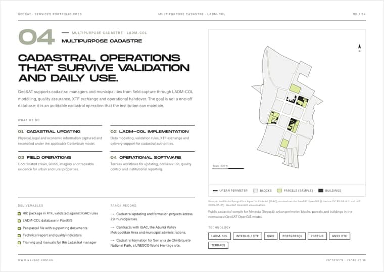
Public cadastral sample for Almeida (Boyacá): urban perimeter, blocks, parcels and buildings in the normalised GeoSAT OpenGIS model.
Technology


MEDELLÍN GEOVISOR · LIVE
Geovisor
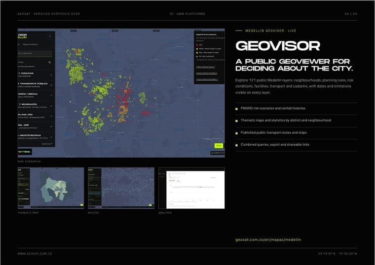
Explore 121 public Medellín layers: neighbourhoods, planning rules, risk conditions, facilities, transport and cadastre, with dates and limitations visible on every layer.
geosat.com.co/en/mapas/medellin


SIAP · ISAGEN · 2026 REDESIGN
SIAP
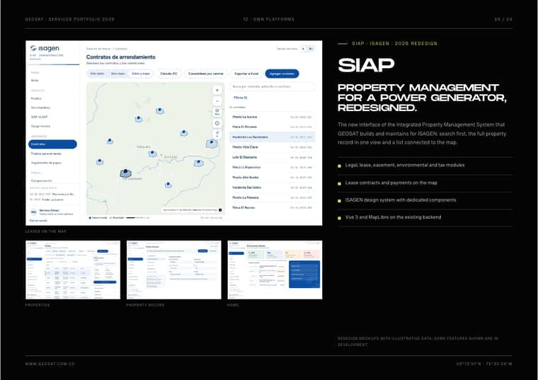
The new interface of the Integrated Property Management System that GEOSAT builds and maintains for ISAGEN: search first, the full property record in one view and a list connected to the map.
Redesign mockups with illustrative data; some features shown are in development.


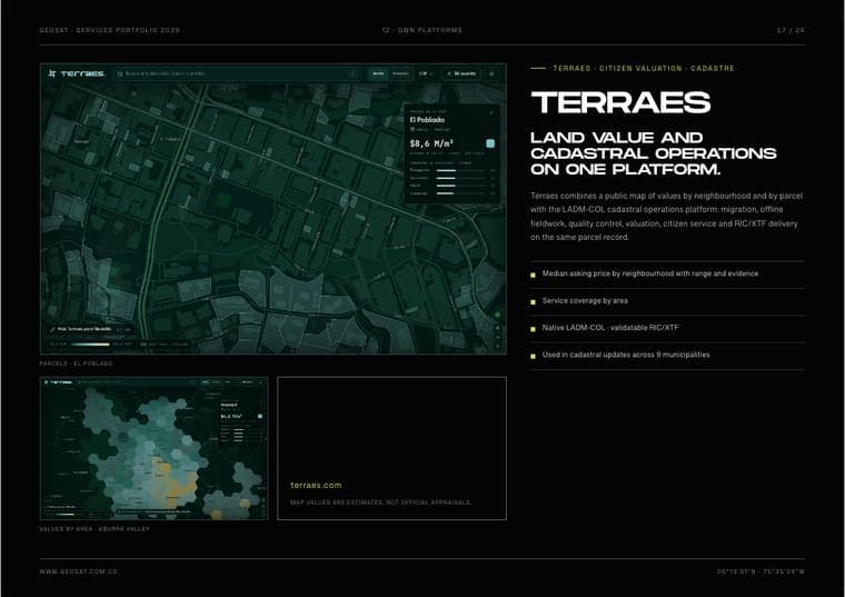
terraes.com
Map values are estimates, not official appraisals.
TERRAES · CITIZEN VALUATION · CADASTRE
Terraes
Terraes combines a public map of values by neighbourhood and by parcel with the LADM-COL cadastral operations platform: migration, offline fieldwork, quality control, valuation, citizen service and RIC/XTF delivery on the same parcel record.
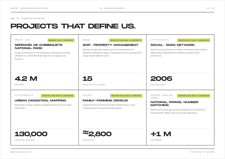
13 · FLAGSHIP PROJECTS
ARD Inc. · IGAC
Registry 2024 · 1 contractSerranía de Chiribiquete National Park
Cadastral formation for the Amazonian national park listed by UNESCO as a mixed World Heritage site, in Caquetá and Guaviare.
ISAGEN
Registry 2010–2025 · 4 contractsSIAP · property management
Spatial and legal information system for the properties of ISAGEN’s hydroelectric plants, integrated with the corporate ERP. Lease module added in 2025.
City of Medellín
Registry 2017–2025 · 4 contractsSGVIAL · road network
Road inventory, pavement condition, intervention planning and public lookup. Migrated from ArcGIS to a GeoSAT-built architecture.
City of Medellín
Registry 2003–2004 · 2 contractsUrban cadastral mapping
Digitisation of urban cadastral mapping linked to the municipal data model.
FAO (UN)
Registry 2022–2023 · 1 contractFamily-farming census
Cadastral census of family farming in Medellín plus a crop-monitoring tool for every characterised plot.
Surtigas · Gases del Caribe
Registry 2021–2023 · 3 contractsNational Parcel Number matching
Matching of natural-gas customer databases to the National Parcel Number (NPN) in line with current regulation.
CONTACT
We reply within 48 business hours with an initial assessment and the next step.
Tell us about your project and we reply within 48 business hours.
Request a consultation →