
Protected land in Medellín
Explore protected-land categories, including environmental components and restricted areas.
Explore these layers ↗Protection categories can overlap: summing their areas does not represent a unique land area. Designation does not confirm public access to the land.
GeoSAT · Public mapping
One city. Many ways to read it.
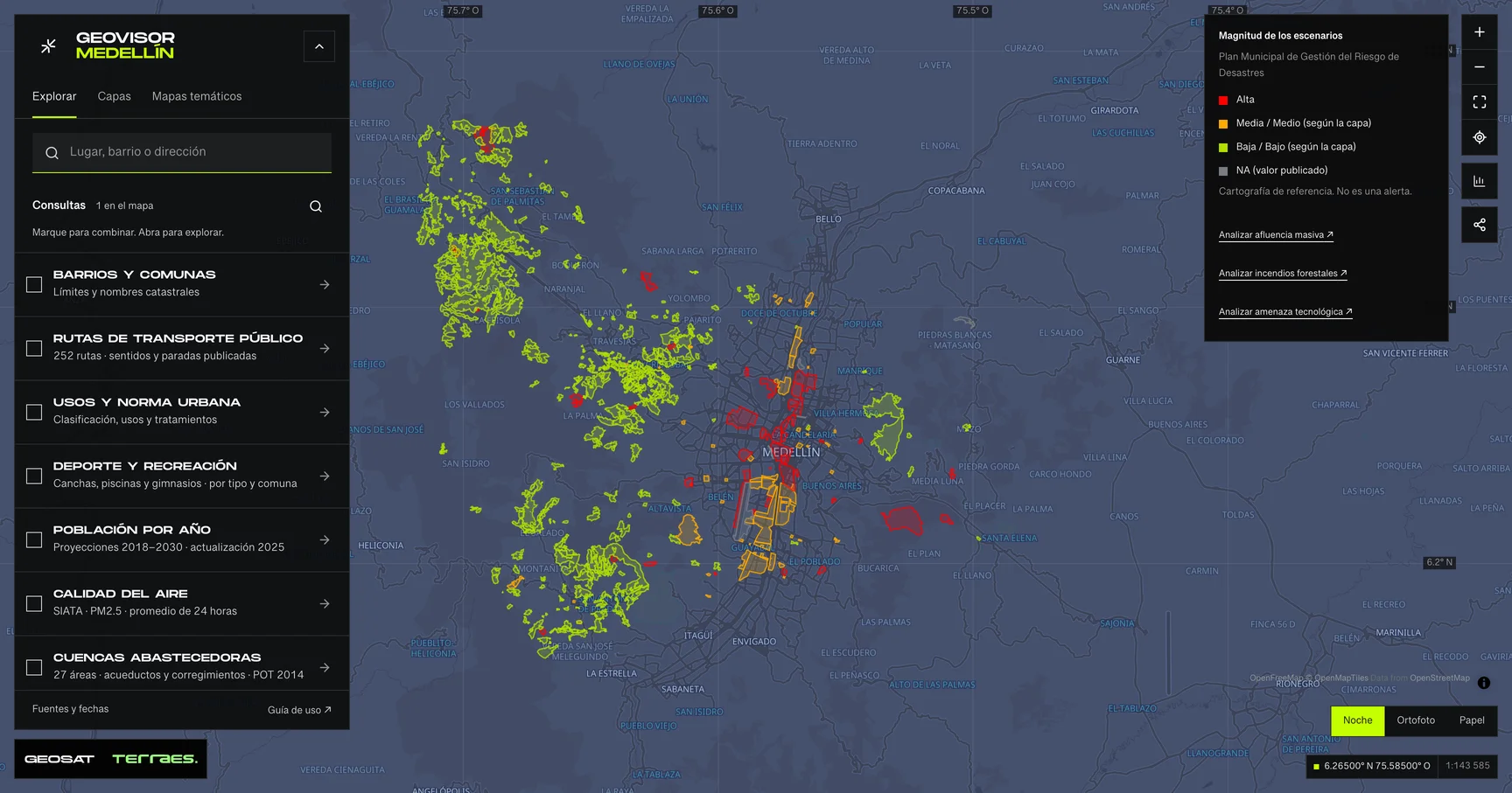
Geovisor view · Municipal Disaster Risk Management Plan scenarios, City of Medellín. Reference mapping: not alerts or events.
How to use itHow to use the map
- Open the prepared query for this theme in the viewer. Search a neighborhood or enter coordinates as latitude, longitude.
- Review enabled layers in the theme and zoom in. Detailed layers require a close scale to keep queries bounded.
- Select a feature on the map or in the Results list. Check its attributes, retrieval time and any partial-result notice.
- Select a feature in Results and inspect its attributes and source. Export contains only received results, with attribution and dates; coverage depends on the queried scope and partial-result notices.
Frequently asked questions
What does Protected land include in the Medellín geovisor?
In Medellín’s Protected land you can explore 1 layer: Protected land. Each layer states its source, date and use limits.
Can I reuse the Protected land data?
According to each layer’s published license: CC BY 4.0. Check the exact license on the layer record before reuse.
How current are the Protected land data?
Layers declare data dates from 2021-06-18 to 2021-06-18. Last GeoSAT verification: 2026-09-25.
How do I explore Protected land in the viewer?
Click “Explore these layers” to open the prepared Protected land query; review enabled layers under Layers. Filter by exact field and value, select features to read their records, and export received results with attribution and dates.
Who publishes the Protected land data?
Layers come from Distrito Especial de Ciencia, Tecnología e Innovación de Medellín · Planeación · servicio AMVA, retrieved and adapted by GeoSAT with per-record attribution and provenance.
Which other themes can I explore?
Other themes in the Medellín geovisor: Metro, cableways and tram, Road infrastructure and taxi stands, and Walking and tactical urbanism.
Sources, dates and limits
Each source’s verification date appears in the table. Retrieval time is not the data update date. Small city-wide layers use the full extent; larger layers depend on the visible area. Reference publications retain their original retrieval date. Each page contains up to 500 features: up to 2 MiB for external services and 4 MiB for local publications. Reference publications load matching pages, up to 5,000 features and 8 MiB per query. External services may return partial samples, identified in the viewer.
| Layer and source | Data date | Reuse |
|---|---|---|
| Protected landDistrito Especial de Ciencia, Tecnología e Innovación de Medellín · Planeación · servicio AMVA | 2021-06-18Source checked: | CC BY 4.0 |
Display transformations and adaptations are described for each source; precision and methods differ between sources. Obtain official mapping if you need surveying accuracy or documents with administrative validity.