
River, streams and wetlands in Medellín
Explore 817 municipal drainage-network records, the published Medellín River polygon and 113 wetland and lagoon polygons from the 2014 land-use plan. Five wetland records have published names; the other 108 retain their identifiers without invented names. Also explore 27 water-supply catchments with published aqueducts and rural districts. Find a stream, compare main and secondary drainage and analyze mapped lengths or areas.
Explore these layers ↗Reference mapping: every record reports an update of December 17, 2014. The five named water bodies are already included in the 113 wetland polygons; do not add both layers as distinct sites. The 817 records are not unique streams, and the 113 polygons do not establish current field-verified wetlands. Length and area describe complete geometries, without clipping to the analysis area or dissolving overlaps. The drainage network retains simplification of up to one meter; wetlands and water-supply catchments retain the full server coordinates. This is not the municipality’s 2025 satellite model and does not establish current channels, setbacks, flow, water quality or flooding. SIATA readings are available separately under River and stream levels.
GeoSAT · Public mapping
One city. Many ways to read it.
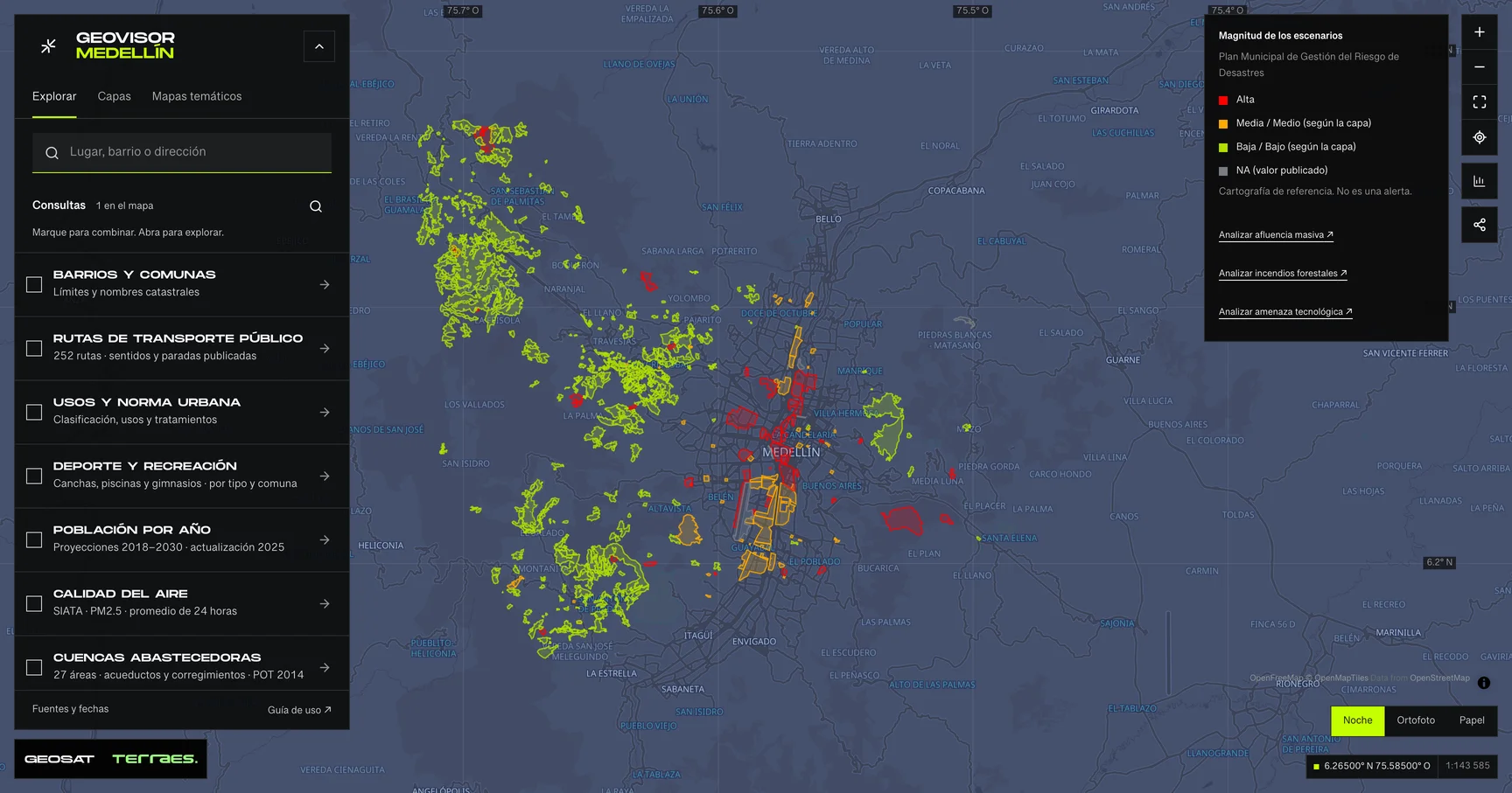
Geovisor view · Municipal Disaster Risk Management Plan scenarios, City of Medellín. Reference mapping: not alerts or events.
How to use itHow to use the map
- Open the prepared query for this theme in the viewer. Search a neighborhood or enter coordinates as latitude, longitude.
- Review enabled layers in the theme and zoom in. Detailed layers require a close scale to keep queries bounded.
- Select a feature on the map or in the Results list. Check its attributes, retrieval time and any partial-result notice.
- Choose a field and exact value to filter the layer. Export includes received results, with attribution and dates. Its coverage depends on the query scope and filters.
Frequently asked questions
What does River, streams and wetlands include in the Medellín geovisor?
In Medellín’s River, streams and wetlands you can explore 5 layers: Wetlands and lagoons · 2014 planning reference, Water-supply catchments · 2014 land-use plan, Drainage network · 2014 reference and 2 more. Each layer states its source, date and use limits.
Can I reuse the River, streams and wetlands data?
According to each layer’s published license: CC BY-SA 4.0 and Cartografía pública municipal · licencia específica no indicada. Check the exact license on the layer record before reuse.
How current are the River, streams and wetlands data?
Layers declare data dates from 2014-12-17 to 2014-12-17. Last GeoSAT verification: 2026-09-29.
How do I explore River, streams and wetlands in the viewer?
Click “Explore these layers” to open the prepared River, streams and wetlands query; review enabled layers under Layers. Filter by exact field and value, select features to read their records, and export received results with attribution and dates.
Who publishes the River, streams and wetlands data?
Layers come from Distrito Especial de Ciencia Tecnología e Innovación de Medellín · GeoMedellín · Departamento Administrativo de Planeación · Subdirección de Planeación Territorial y Estratégica de Ciudad · Adaptación GeoSAT: selección de atributos, fechas UTC ISO, geometrías WGS84 originales sin simplificar y área cartográfica calculada en EPSG:9377, Distrito Especial de Ciencia Tecnología e Innovación de Medellín - GeoMedellín - Dato proporcionado por Departamento Administrativo de Planeación - Subdirección de Planeación Territorial y Estratégica de Ciudad · Adaptación GeoSAT: selección de atributos y fechas ISO; conversión WGS84 del servidor original, sin redondeo ni simplificación de geometrías, and Distrito de Medellín · GeoMedellín · Departamento Administrativo de Planeación · Secretaría de Medio Ambiente · Adaptación GeoSAT: consulta WGS84, atributos seleccionados, fechas UTC en formato ISO, simplificación topológica hasta 1 m; longitudes calculadas en EPSG:9377 antes de simplificar, retrieved and adapted by GeoSAT with per-record attribution and provenance.
Which other themes can I explore?
Other themes in the Medellín geovisor: Metro, cableways and tram, Road infrastructure and taxi stands, and Walking and tactical urbanism.
Sources, dates and limits
Each source’s verification date appears in the table. Retrieval time is not the data update date. Small city-wide layers use the full extent; larger layers depend on the visible area. Reference publications retain their original retrieval date. Each page contains up to 500 features: up to 2 MiB for external services and 4 MiB for local publications. Reference publications load matching pages, up to 5,000 features and 8 MiB per query. External services may return partial samples, identified in the viewer.
| Layer and source | Data date | Reuse |
|---|---|---|
| Wetlands and lagoons · 2014 planning referenceDistrito Especial de Ciencia Tecnología e Innovación de Medellín · GeoMedellín · Departamento Administrativo de Planeación · Subdirección de Planeación Territorial y Estratégica de Ciudad · Adaptación GeoSAT: selección de atributos, fechas UTC ISO, geometrías WGS84 originales sin simplificar y área cartográfica calculada en EPSG:9377 113 polygons from the land-use plan’s ecological-structure map: five have published names and 108 do not. Metadata lists the five known water bodies, but its geometric count also states 113. These are not 113 distinct wetlands verified in the field. The five named records already appear in Reference water bodies: do not add the two layers as separate sites. All records state adoption and update on December 17, 2014; metadata declares a March 19, 2015 revision. Complete original geometry is retained. Calculated area describes the mapped footprint, not available water, ecological condition or current boundaries. Wetland setbacks are not included, and public access is not established; consult the adopted map and competent authority. Mapa 04 protocolizado · humedales / Adopted Map 04 · wetlands ↗ Publicación ambiental equivalente / Equivalent environmental publication ↗ | 2014-12-17Source checked: | CC BY-SA 4.0 |
| Water-supply catchments · 2014 land-use planDistrito Especial de Ciencia Tecnología e Innovación de Medellín - GeoMedellín - Dato proporcionado por Departamento Administrativo de Planeación - Subdirección de Planeación Territorial y Estratégica de Ciudad · Adaptación GeoSAT: selección de atributos y fechas ISO; conversión WGS84 del servidor original, sin redondeo ni simplificación de geometrías 27 rural water-supply catchments and subcatchments published for the 2014 land-use plan at 1:5,000 scale. Every record has adoption and update dates of December 17, 2014; the metadata was published and revised on March 19, 2015. Every component, hole and WGS84 coordinate returned by the server is preserved. Five records do not name an aqueduct and two do not name a rural district. These areas relate to reserves and aqueducts in other layers: their areas should not be added as independent coverage. They do not describe flow, water quality or current water-supply operation. For regulatory decisions consult the adopted map of Agreement 48 of 2014. | 2014-12-17Source checked: | CC BY-SA 4.0 |
| Drainage network · 2014 referenceDistrito de Medellín · GeoMedellín · Departamento Administrativo de Planeación · Secretaría de Medio Ambiente · Adaptación GeoSAT: consulta WGS84, atributos seleccionados, fechas UTC en formato ISO, simplificación topológica hasta 1 m; longitudes calculadas en EPSG:9377 antes de simplificar | 2014-12-17Source checked: | Cartografía pública municipal · licencia específica no indicada |
| Medellín River · 2014 reference polygonDistrito de Medellín · GeoMedellín · Departamento Administrativo de Planeación · Secretaría de Medio Ambiente · Adaptación GeoSAT: consulta WGS84, atributos seleccionados, fechas UTC en formato ISO, simplificación topológica hasta 1 m; longitudes calculadas en EPSG:9377 antes de simplificar | 2014-12-17Source checked: | Cartografía pública municipal · licencia específica no indicada |
| Water bodies · 2014 referenceDistrito de Medellín · GeoMedellín · Departamento Administrativo de Planeación · Secretaría de Medio Ambiente · Adaptación GeoSAT: consulta WGS84, atributos seleccionados, fechas UTC en formato ISO, simplificación topológica hasta 1 m; longitudes calculadas en EPSG:9377 antes de simplificar Five named water bodies, also included in the 113 polygons of Wetlands and lagoons · 2014 planning reference. This representation and its earlier links remain available; do not add both layers as distinct sites. Published dates are December 17, 2014 and do not establish current condition or access. | 2014-12-17Source checked: | Cartografía pública municipal · licencia específica no indicada |
Display transformations and adaptations are described for each source; precision and methods differ between sources. Obtain official mapping if you need surveying accuracy or documents with administrative validity.