
Public Wi-Fi locations in Medellín
332 inventory sites · no live availability.
1 layer · 332 published map features · Distrito Especial de Ciencia Tecnología e Innovación de Medellín · GeoMedellín · Adaptación GeoSAT: selección y nombres de atributos públicos; geometría WGS84 transformada por el servicio de origen sin simplificación
Open this query ↗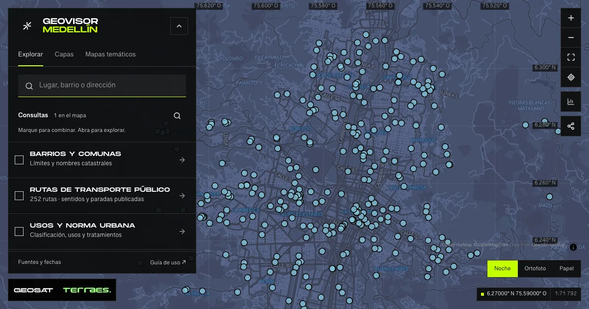
What it includes
- Free Wi-Fi sites · municipal inventory
332 map features · date not declared · Inventario público municipal · licencia específica no indicada
Distrito Especial de Ciencia Tecnología e Innovación de Medellín · GeoMedellín · Adaptación GeoSAT: selección y nombres de atributos públicos; geometría WGS84 transformada por el servicio de origen sin simplificación · Source checked: 2026-09-28
The source declares no update date. Points do not confirm a working connection today, speed, signal range, capacity or access conditions. Territory codes are retained, including one SN01 record without a declared equivalent. Two records share coordinates. A point does not represent the area covered by a signal. The service declares no specific reuse license.
Official source ↗
How to use it
- Click “Open this query” to load Free Wi-Fi sites · municipal inventory in the viewer.
- Select a feature on the map or in the Results list to read its record with attributes, source and date.
- Build a thematic map to compare, or open statistics to analyze the loaded data.
- Share the view link or export received results with attribution and dates.
Frequently asked questions
What does “Public Wi-Fi locations” open on the map?
332 inventory sites · no live availability: 1 layer (Free Wi-Fi sites · municipal inventory), with 332 published map features.
Where do the data come from, and how can they be reused?
Layers come from Distrito Especial de Ciencia Tecnología e Innovación de Medellín · GeoMedellín · Adaptación GeoSAT: selección y nombres de atributos públicos; geometría WGS84 transformada por el servicio de origen sin simplificación. Published licenses: Inventario público municipal · licencia específica no indicada. Each record retains its source and date; check the exact license before reuse.
Are the results complete?
This query loads 1 layer from reference publications by pages within the queried area, up to 5,000 map features and 8 MiB per layer. Wait for loading to finish before interpreting statistics; zoom in if the limit is exceeded. The queried area is not the complete municipal inventory.
Do I need an account or payment?
No. The Medellín geovisor is free with no account: open the query, explore, export received results and share the link. Last GeoSAT verification: 2026-09-28.