
Metro, cableways and tram in Medellín
Lines and stations · inventory statuses.
2 layers · 95 published map features · Distrito Especial de Ciencia Tecnología e Innovación de Medellín · GeoMedellín · Adaptación GeoSAT: selección y nombres de atributos; categorías de dominios y leyendas oficiales; geometría WGS84 del servicio, sin simplificación, con al menos siete decimales
Open this query ↗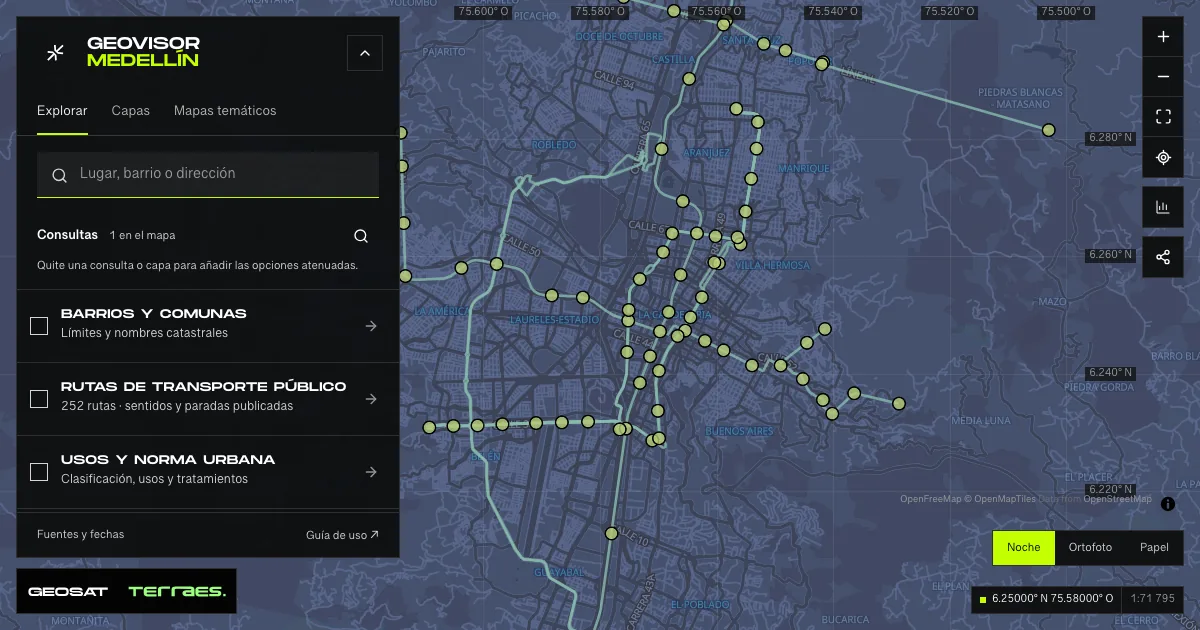
What it includes
- Mass-transit lines · municipal reference
14 map features · date not declared · Cartografía pública municipal · licencia específica no indicada
Distrito Especial de Ciencia Tecnología e Innovación de Medellín · GeoMedellín · Adaptación GeoSAT: selección y nombres de atributos; categorías de dominios y leyendas oficiales; geometría WGS84 del servicio, sin simplificación, con al menos siete decimales · Source checked: 2026-09-28
14 municipal paths with 13 line names: 12 records marked “Existente”, one “En Ejecución” and one “En Estudio” by the published domain. Types are decoded from the official legend. Every record lacks an update date; statuses do not establish current operations or construction progress. Geometry retains separate parts and does not by itself define travel direction, stops or navigable itineraries. This is not live train or cable-car tracking. The service declares no specific reuse license.
Official source ↗ - Mass-transit stations · municipal reference
81 map features · date not declared · Cartografía pública municipal · licencia específica no indicada
Distrito Especial de Ciencia Tecnología e Innovación de Medellín · GeoMedellín · Adaptación GeoSAT: selección y nombres de atributos; categorías de dominios y leyendas oficiales; geometría WGS84 del servicio, sin simplificación, con al menos siete decimales · Source checked: 2026-09-28
81 station and stop records: 77 marked “Existente” and four “Proyectado” by the source. Metro, Metrocable, Metroplús and Tram types are decoded from the official legend; statuses use the service domain. Every record lacks an update date. Neighboring-municipality stations and records by line are retained; these are not 81 unique Medellín stations or a current operating map. No frequencies, timetables, vehicles or verified accessibility are published. The service declares no specific reuse license.
Official source ↗
How to use it
- Click “Open this query” to load Mass-transit lines · municipal reference and Mass-transit stations · municipal reference in the viewer.
- Select a feature on the map or in the Results list to read its record with attributes, source and date.
- Build a thematic map to compare, or open statistics to analyze the loaded data.
- Share the view link or export received results with attribution and dates.
Frequently asked questions
What does “Metro, cableways and tram” open on the map?
Lines and stations · inventory statuses: 2 layers (Mass-transit lines · municipal reference and Mass-transit stations · municipal reference), with 95 published map features.
Where do the data come from, and how can they be reused?
Layers come from Distrito Especial de Ciencia Tecnología e Innovación de Medellín · GeoMedellín · Adaptación GeoSAT: selección y nombres de atributos; categorías de dominios y leyendas oficiales; geometría WGS84 del servicio, sin simplificación, con al menos siete decimales. Published licenses: Cartografía pública municipal · licencia específica no indicada. Each record retains its source and date; check the exact license before reuse.
Are the results complete?
This query loads 2 layers from reference publications by pages within the queried area, up to 5,000 map features and 8 MiB per layer. Wait for loading to finish before interpreting statistics; zoom in if the limit is exceeded. The queried area is not the complete municipal inventory.
Do I need an account or payment?
No. The Medellín geovisor is free with no account: open the query, explore, export received results and share the link. Last GeoSAT verification: 2026-09-28.