
Restoration and seed-source trees in Medellín
Interventions and species · inventories through 2025.
2 layers · 249 published map features · Distrito de Medellín · Secretaría de Medio Ambiente · Subsecretaría de Recursos Naturales Renovables · Adaptación GeoSAT: atributos seleccionados, fechas UTC en formato ISO y coordenadas WGS84 redondeadas a siete decimales, sin simplificación
Open this query ↗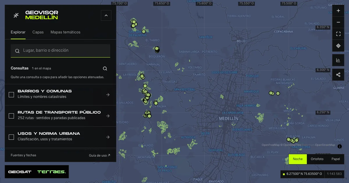
What it includes
- Forest interventions · Más Bosques
160 map features · 2025-05-29 · Cartografía pública municipal · licencia específica no indicada
Distrito de Medellín · Secretaría de Medio Ambiente · Subsecretaría de Recursos Naturales Renovables · Adaptación GeoSAT: atributos seleccionados, fechas UTC en formato ISO y coordenadas WGS84 redondeadas a siete decimales, sin simplificación · Source checked: 2026-09-28
160 Más Bosques para Medellín project polygons. The service describes interventions and maintenance from 2009 through May 29, 2025; published individual establishment dates run from 2010 to May 2025. Planted-tree counts and hectares are inventory attributes, not survival counts or current canopy. Farm and owner names and free-text observations are excluded. Full unsimplified geometries; the service states no specific reuse license.
Official source ↗ - Seed-source trees · reserves
89 map features · 2025-05-15 · Cartografía pública municipal · licencia específica no indicada
Distrito de Medellín · Secretaría de Medio Ambiente · Subsecretaría de Recursos Naturales Renovables · Adaptación GeoSAT: atributos seleccionados, fechas UTC en formato ISO y coordenadas WGS84 redondeadas a siete decimales, sin simplificación · Source checked: 2026-09-28
89 trees recorded inside project reserves; the service describes work from March 2024 to May 2025. Individual survey dates run from May 31, 2024 to May 15, 2025. Tree codes are not unique, so each record retains its source ID. Diameter at breast height and tree height are published measurements, not current values. Property names and free-text observations are excluded. Location does not grant access. The service states no specific reuse license.
Official source ↗
How to use it
- Click “Open this query” to load Forest interventions · Más Bosques and Seed-source trees · reserves in the viewer.
- Select a feature on the map or in the Results list to read its record with attributes, source and date.
- Build a thematic map to compare, or open statistics to analyze the loaded data.
- Share the view link or export received results with attribution and dates.
Frequently asked questions
What does “Restoration and seed-source trees” open on the map?
Interventions and species · inventories through 2025: 2 layers (Forest interventions · Más Bosques and Seed-source trees · reserves), with 249 published map features.
Where do the data come from, and how can they be reused?
Layers come from Distrito de Medellín · Secretaría de Medio Ambiente · Subsecretaría de Recursos Naturales Renovables · Adaptación GeoSAT: atributos seleccionados, fechas UTC en formato ISO y coordenadas WGS84 redondeadas a siete decimales, sin simplificación. Published licenses: Cartografía pública municipal · licencia específica no indicada. Each record retains its source and date; check the exact license before reuse.
Are the results complete?
This query loads 2 layers from reference publications by pages within the queried area, up to 5,000 map features and 8 MiB per layer. Wait for loading to finish before interpreting statistics; zoom in if the limit is exceeded. The queried area is not the complete municipal inventory.
Do I need an account or payment?
No. The Medellín geovisor is free with no account: open the query, explore, export received results and share the link. Last GeoSAT verification: 2026-09-28.