
Land use and planning in Medellín
Find a parcel, confirm its outline and read its intersections with planning sources. Switch topics while keeping the parcel and its matching legend.
24 topics · municipal tables and parcel mapping · Medellín and metropolitan IDEM
Open this query ↗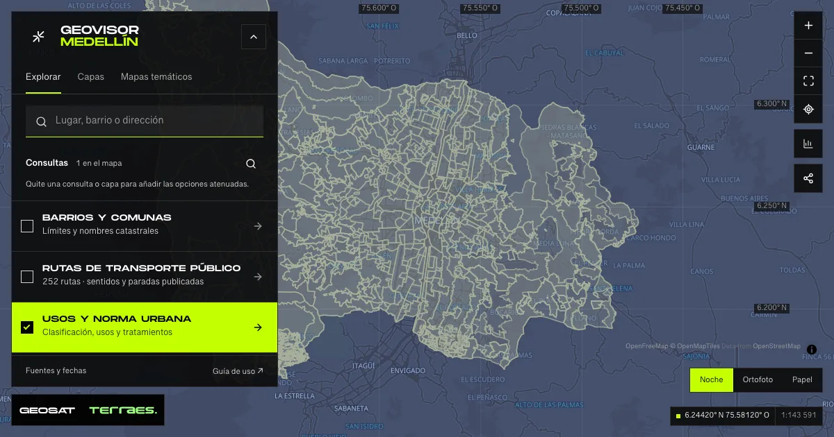
What it includes
- Classification
Distinguishes urban, rural and expansion land. A parcel can intersect several classes; inspect every part.
Official source ↗ - Urban use
Categories describe general land uses. A specific activity needs its own consultation; this category does not grant a licence.
Official source ↗ - Rural use
Retains rural and protection categories. Inspect this theme also when a parcel crosses the urban-rural boundary.
Official source ↗ - Treatment
Treatment directs planning actions such as consolidation, conservation or renewal. Its code identifies the planning polygon; it is not a building permit.
Official source ↗ - Development parameters
Density: dwellings/ha. Floor-area ratio: floor m²/land m². Numeric height: floors. Density and ratio use net area, except Development treatment (gross area). “N/A” and “Variable” remain unchanged. These values multiplied by cadastral area do not establish permitted capacity.
Official source ↗ - Risk conditions
Inspect the published type and description. No intersection in this layer does not establish safety or complete the hazard checks.
Official source ↗ - Protected land
Inspect each category and its extent. This check alone does not cover every setback, public dedication, heritage rule or applicable obligation.
Official source ↗ - Flood hazard
Planning hazard degrees, not observed floods or forecasts. Separate from torrent-flow hazards and risk conditions.
Official source ↗ - Landslide hazard
Mapped hazard is not a parcel stability assessment. Review dates, categories and detailed studies with the municipal source.
Official source ↗ - Torrent-flow hazard
This hazard has its own classification and legend. It is distinct from flood hazard and is not a real-time warning.
Official source ↗ - Urban roads
The municipal table identifies the parcel’s road relationship. Map lines provide context; GeoSAT does not turn them into affected areas.
Official source ↗ - Rural roads
Rural road consultation; retain the urban consultation too for parcels crossing land classes.
Official source ↗ - Heritage
Review the municipal table, parcel notices and Decree 593 of 2021. LICBIC candidate status and a BIC declaration are different conditions.
Official source ↗ - Complementary planning instruments
Identifies planning instruments associated with the parcel. Their documents and administrative acts establish specific conditions.
Official source ↗ - Public dedications
Open the municipal document for each treatment code. An isolated value multiplied by parcel area does not establish an obligation.
Official source ↗ - Proposed public space
A planning designation does not establish construction, acquisition or public access.
Official source ↗ - Road projects
Inspect road sections returned by the source. Mapping does not establish that a project has been built.
Official source ↗ - Parking requirements
Stratum is a municipal report parameter. Open the parking rules; the table does not count existing parking spaces.
Official source ↗ - Building form and habitability
Consult official documents for minimum dwelling floor area and minimum parcel area and frontage.
Official source ↗ - River and stream setbacks
Queries municipal restrictions and mapping. No generic watercourse buffers are treated as legal setbacks.
Official source ↗ - Ecological structure
Includes protected areas, salt springs, catchments, wetlands, setbacks, orography and connectivity. Review every published condition.
Official source ↗ - Rural treatment
Treatments returned by the official rural query. Mixed parcels require both scopes.
Official source ↗ - Rural development parameters
Open the municipal maximum rural height report for the confirmed parcel.
Official source ↗ - Rural habitability
Minimum areas published by the rural query. A source error never means absence of restrictions.
Official source ↗
How to use it
- Open Property in the viewer. Choose address, 11-digit CBML or property registry number; you can also select a parcel on the map. Registry search queries the municipal folio and does not verify the registry office.
- Confirm the outline before querying: a parcel can contain several buildings or units. CBML identifies district, neighborhood, block and parcel; it is not the registry number of an apartment.
- Under Topics and results, switch between classification, uses, treatment, development parameters, protection, risk and hazards. The parcel stays selected while the map, results and legend change together. Question-mark help explains terms and statuses on hover, keyboard focus or tap.
- Read each intersection with the entire parcel. The percentage is the area covered by one polygon, not development capacity or risk probability. Select a card to highlight it and open Published values for its attributes. Do not add overlapping polygons.
- Open Source query status. A query with no intersections did receive a response; an unavailable query failed and cannot establish the absence of a condition. A partial response retains successful results and identifies missing ones. The count does not certify a complete planning review.
- Open Source, dates and method. Retrieval date records when the source responded; it does not establish legal validity. For density, floor-area ratio and height, check the calculation basis and the conditions of Agreement 48 of 2014.
- Use Compare another to read the same topic for two parcels. Copy link retains CBML identifiers and the topic; opening it queries sources again. Print brief includes topics, statuses, notices and the active map with its legend. Wait for mapping to load before printing.
- Review municipal tables and documents for PAU, setbacks, heritage, roads, dedications, public space, parking, habitability and instruments. Use the urban/rural filter and retain both scopes for mixed parcels. Context maps do not represent calculated intersections. Review Notices before opening reports. Compare with the 2026 proposal in its section: it is not adopted law; inspect coverage and errors for each source.
- To study public-space proposals beyond the parcel brief, return to Explore and open Proposed public space. Its 480 records belong to the 2014 plan: compare Category, Subcategory or Level in Thematic maps. For example, Mirador Panorámico includes 29 records. Polygons do not establish open parks or completed works; keep them separate from Parks and public space and do not sum their areas as additional land.
Check Medellín planning maps step by step →
Frequently asked questions
How do I check planning conditions for a parcel?
Open Property and choose address, 11-digit CBML or property registry number; you can also select on the map. Registry search uses the folio and does not verify the office prefix. Confirm the outline before querying. The parcel stays selected when switching topics and the legend updates.
What does a result percentage mean?
In GeoSAT intersections, it is the share of the geometric parcel area covered by a polygon. It is not development capacity or a risk percentage. Municipal tables retain their own values and may use a different data version. Do not add overlapping polygons or percentages from different sources.
Which topics and documents are included?
Includes urban and rural queries for classification, uses, treatments, development, roads, heritage, instruments, dedications, public space, parking, habitability, setbacks, ecological structure, protection and hazards. Municipal PAU and other planning documents are offered when permitted by the source, alongside parcel notices. It does not replace an official planning determination or licence.
What happens if a source fails, and how do I read the 2026 proposal?
Partial or unavailable responses remain identified; they do not mean no condition applies. Each query retains its source and retrieval date. The comparison queries the 2026 proposal separately from Acuerdo 48 and shows its coverage: a proposal is not adopted law, and retrieval date does not establish legal validity.
Can I compare, share and save without an account?
Yes. Compare two parcels within a topic, copy a link that queries sources again, and print a brief with results, statuses, notices and the active map with its legend. Wait for the map to load before printing. The registry number is not included in the link; CBML identifiers are.