
Bus stops in this area in Medellín
Stop locations, associated routes and record dates.
1 layer · service queried by area · Distrito Especial de Ciencia Tecnología e Innovación de Medellín · GeoMedellín · Dato proporcionado por Departamento Administrativo de Planeación · Subdirección de Planeación Territorial y Estratégica de Ciudad · Secretaría de Movilidad. Adaptación GeoSAT: selección de atributos, consulta por ruta y transformación WGS84 del servicio municipal. CC BY-SA 4.0.
Open this query ↗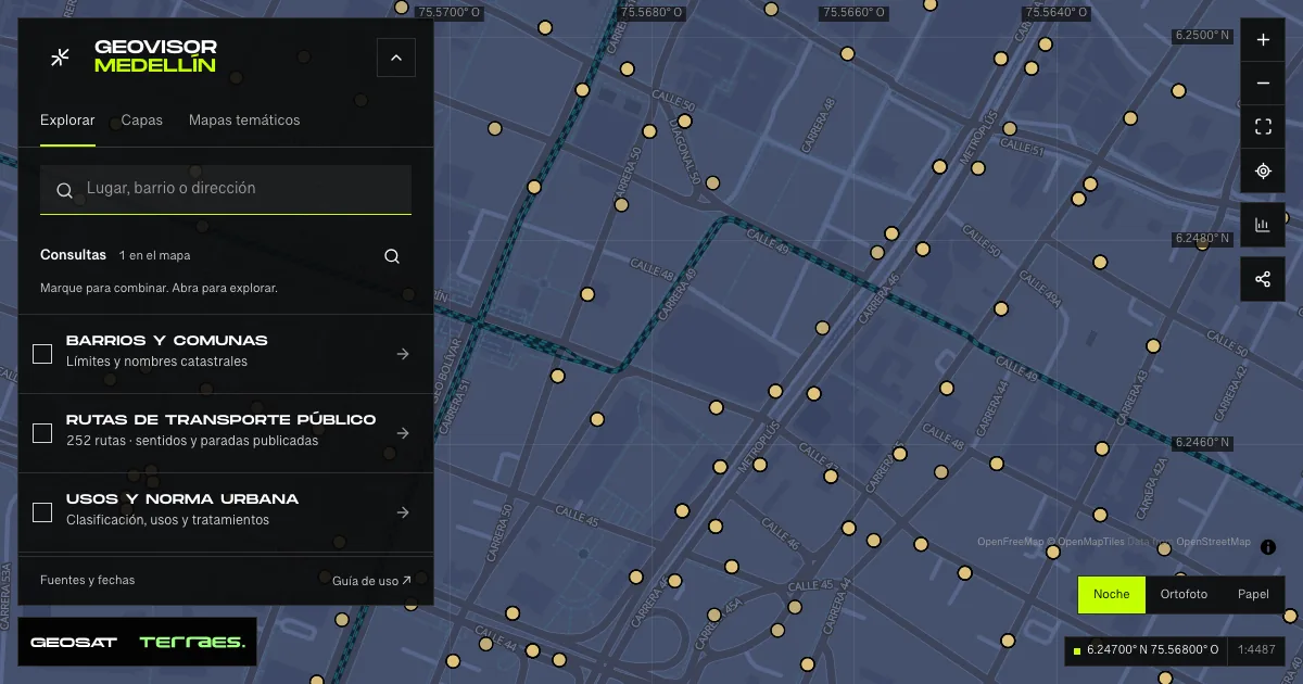
What it includes
- Bus stops · route and direction records
Queried per area · up to 500 records · date not declared · CC BY-SA 4.0
Distrito Especial de Ciencia Tecnología e Innovación de Medellín · GeoMedellín · Dato proporcionado por Departamento Administrativo de Planeación · Subdirección de Planeación Territorial y Estratégica de Ciudad · Secretaría de Movilidad. Adaptación GeoSAT: selección de atributos, consulta por ruta y transformación WGS84 del servicio municipal. CC BY-SA 4.0. · Source checked: 2026-09-28
At verification on September 28, 2026, 10,043 records linked 3,590 physical stop identifiers to 247 of the viewer’s 252 routes. Records join by route identifier and published direction; the same physical stop can occur on several routes. Stops exist for 493 of 504 paths: five routes and one additional direction have no matching records. Record dates range from August 1, 2018 to February 27, 2026; 6,882 records retain the 2018 date. Published numbering can continue between directions, skip or repeat: records are neither renumbered nor deduplicated. The source describes approximate positions derived from grouped CAD points. Those positions remain unchanged even where they differ from paths; there are no timetables, arrivals, verified accessibility or live vehicles. Queries cover the visible area and at most 500 records; select a route to review its stops. Dataset metadata declares CC BY-SA 4.0; its edit date does not replace individual record dates.
Official source ↗Metadatos y linaje / Metadata and lineage ↗
How to use it
- Click “Open this query” to load Bus stops · route and direction records in the viewer.
- Select a feature on the map or in the Results list to read its record with attributes, source and date.
- Build a thematic map to compare, or open statistics to analyze the loaded data.
- Share the view link or export received results with attribution and dates.
Frequently asked questions
What does “Bus stops in this area” open on the map?
Stop locations, associated routes and record dates: 1 layer (Bus stops · route and direction records), with 1 queried live per area.
Where do the data come from, and how can they be reused?
Layers come from Distrito Especial de Ciencia Tecnología e Innovación de Medellín · GeoMedellín · Dato proporcionado por Departamento Administrativo de Planeación · Subdirección de Planeación Territorial y Estratégica de Ciudad · Secretaría de Movilidad. Adaptación GeoSAT: selección de atributos, consulta por ruta y transformación WGS84 del servicio municipal. CC BY-SA 4.0.. Published licenses: CC BY-SA 4.0. Each record retains its source and date; check the exact license before reuse.
Are the results complete?
This query loads 1 layer within the visible area, up to 500 records per zone: zoom in to complete a sector. A partial-result notice means you are not seeing the whole inventory.
Do I need an account or payment?
No. The Medellín geovisor is free with no account: open the query, explore, export received results and share the link. Last GeoSAT verification: 2026-09-28.