
Geodetic network in Medellín
Control points, reviews and Cartesian areas.
2 layers · 1,094 published map features · Distrito Especial de Ciencia Tecnología e Innovación de Medellín · GeoMedellín · Adaptación GeoSAT: selección y nombres de atributos, fechas ISO; geometría WGS84 del servicio sin simplificación
Open this query ↗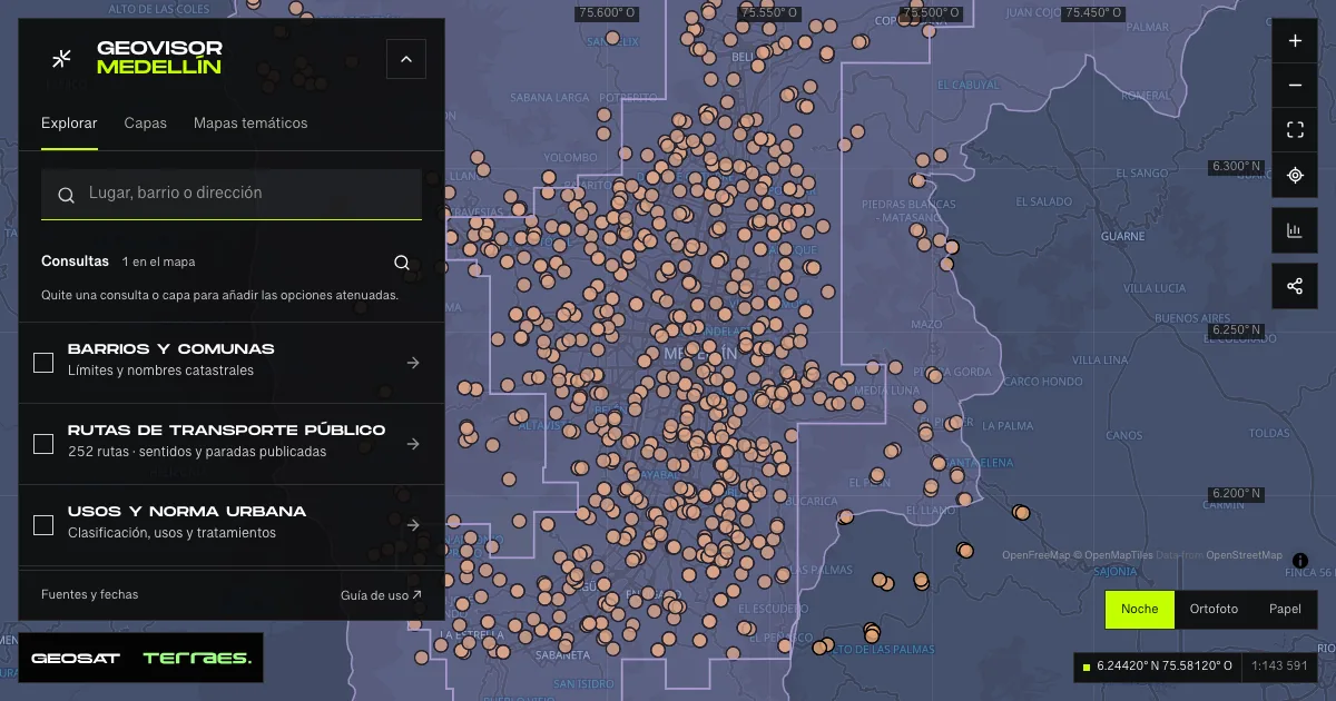
What it includes
- Geodetic control points · 2010–2019 reviews
1,089 map features · date not declared · Cartografía pública municipal · licencia específica no indicada
Distrito Especial de Ciencia Tecnología e Innovación de Medellín · GeoMedellín · Adaptación GeoSAT: selección y nombres de atributos, fechas ISO; geometría WGS84 del servicio sin simplificación · Source checked: 2026-09-28
The archive contains 1,089 control points across several municipalities and five origin areas, not an inventory exclusive to Medellín. Recorded reviews span 2010–2019 and 21 points have no date; the published “Disponible” status does not confirm their current condition. Reference locations and areas do not replace official records, transformation parameters or field verification. No specific reuse license is declared.
Official source ↗ - Cartesian-origin areas · MAGNA Aburrá Valley
5 map features · date not declared · Cartografía pública municipal · licencia específica no indicada
Distrito Especial de Ciencia Tecnología e Innovación de Medellín · GeoMedellín · Adaptación GeoSAT: selección y nombres de atributos, fechas ISO; geometría WGS84 del servicio sin simplificación · Source checked: 2026-09-28
Five published areas: Barbosa, Caldas, Girardota, Medellin 2K and Medellin 5K, including territory beyond the viewer extent. The scale field remains as published, without assigning undocumented accuracy or units. No review date is provided. The polygons do not contain the parameters required to transform coordinates or establish a reference system’s current validity. The service declares no specific reuse license.
Official source ↗
How to use it
- Click “Open this query” to load Geodetic control points · 2010–2019 reviews and Cartesian-origin areas · MAGNA Aburrá Valley in the viewer.
- Select a feature on the map or in the Results list to read its record with attributes, source and date.
- Build a thematic map to compare, or open statistics to analyze the loaded data.
- Share the view link or export received results with attribution and dates.
Prepare a geodetic control-point query →
Frequently asked questions
What does “Geodetic network” open on the map?
Control points, reviews and Cartesian areas: 2 layers (Geodetic control points · 2010–2019 reviews and Cartesian-origin areas · MAGNA Aburrá Valley), with 1,094 published map features.
Where do the data come from, and how can they be reused?
Layers come from Distrito Especial de Ciencia Tecnología e Innovación de Medellín · GeoMedellín · Adaptación GeoSAT: selección y nombres de atributos, fechas ISO; geometría WGS84 del servicio sin simplificación. Published licenses: Cartografía pública municipal · licencia específica no indicada. Each record retains its source and date; check the exact license before reuse.
Are the results complete?
This query loads 2 layers from reference publications by pages within the queried area, up to 5,000 map features and 8 MiB per layer. Wait for loading to finish before interpreting statistics; zoom in if the limit is exceeded. The queried area is not the complete municipal inventory.
Do I need an account or payment?
No. The Medellín geovisor is free with no account: open the query, explore, export received results and share the link. Last GeoSAT verification: 2026-09-28.