
Proposed public space in Medellín
2014 planning proposals · by category and level.
1 layer · 480 published map features · Distrito Especial de Ciencia Tecnología e Innovación de Medellín · GeoMedellín · Departamento Administrativo de Planeación · Subdirección de Planeación Territorial y Estratégica de Ciudad · Adaptación GeoSAT: selección de atributos, transformación WGS84 del servicio, área original calculada en EPSG:9377 y simplificación de hasta 0,5 m con preservación de componentes y huecos
Open this query ↗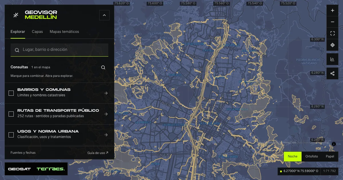
What it includes
- Proposed public space · 2014 land-use plan
480 map features · 2014-12-17 · CC BY-SA 4.0
Distrito Especial de Ciencia Tecnología e Innovación de Medellín · GeoMedellín · Departamento Administrativo de Planeación · Subdirección de Planeación Territorial y Estratégica de Ciudad · Adaptación GeoSAT: selección de atributos, transformación WGS84 del servicio, área original calculada en EPSG:9377 y simplificación de hasta 0,5 m con preservación de componentes y huecos · Source checked: 2026-09-28
480 proposed public-space records from the 2014 land-use plan, with seven categories, twelve subcategories and six published levels. These are planning proposals, not open parks or completed works. The queried service contains 480 IDs; the metadata retains an earlier count of 478. Every record states adoption and update dates of December 17, 2014; metadata was published and revised on March 19, 2015 and mentions a 2018 resolution without changing those record dates. Retrieval in 2026 does not establish current regulatory status. Every geometry component and hole is retained; simplification is up to 0.5 m, with area change below 1%. Area (m²) is calculated from the original polygon in EPSG:9377. Records may share names and overlap other inventories: record counts are not unique park counts, and area sums do not measure existing public space or additional available land. Verify the applicable planning instrument before making development decisions.
Official source ↗Metadato y licencia / Metadata and license ↗
How to use it
- Click “Open this query” to load Proposed public space · 2014 land-use plan in the viewer.
- Select a feature on the map or in the Results list to read its record with attributes, source and date.
- Build a thematic map to compare, or open statistics to analyze the loaded data.
- Share the view link or export received results with attribution and dates.
Frequently asked questions
What does “Proposed public space” open on the map?
2014 planning proposals · by category and level: 1 layer (Proposed public space · 2014 land-use plan), with 480 published map features.
Where do the data come from, and how can they be reused?
Layers come from Distrito Especial de Ciencia Tecnología e Innovación de Medellín · GeoMedellín · Departamento Administrativo de Planeación · Subdirección de Planeación Territorial y Estratégica de Ciudad · Adaptación GeoSAT: selección de atributos, transformación WGS84 del servicio, área original calculada en EPSG:9377 y simplificación de hasta 0,5 m con preservación de componentes y huecos. Published licenses: CC BY-SA 4.0. Each record retains its source and date; check the exact license before reuse.
Are the results complete?
This query loads 1 layer from reference publications by pages within the queried area, up to 5,000 map features and 8 MiB per layer. Wait for loading to finish before interpreting statistics; zoom in if the limit is exceeded. The queried area is not the complete municipal inventory.
Do I need an account or payment?
No. The Medellín geovisor is free with no account: open the query, explore, export received results and share the link. Last GeoSAT verification: 2026-09-28.