
Enterprise support and employment in Medellín
CEDEZO centers and OPE offices · published locations.
2 layers · 33 published map features · Distrito Especial de Ciencia Tecnología e Innovación de Medellín · GeoMedellín · Adaptación GeoSAT: selección y nombres de atributos públicos; geometría WGS84 transformada por el servicio de origen sin simplificación · Secretaría de Desarrollo Económico · Subsecretaría de Creación y Fortalecimiento Empresarial
Open this query ↗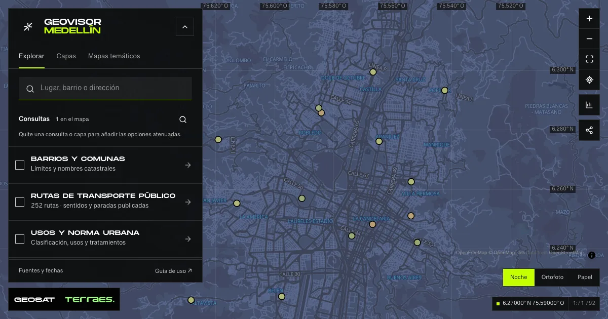
What it includes
- Enterprise development centers · CEDEZO
16 map features · date not declared · Inventario público municipal · licencia específica no indicada
Distrito Especial de Ciencia Tecnología e Innovación de Medellín · GeoMedellín · Adaptación GeoSAT: selección y nombres de atributos públicos; geometría WGS84 transformada por el servicio de origen sin simplificación · Secretaría de Desarrollo Económico · Subsecretaría de Creación y Fortalecimiento Empresarial · Source checked: 2026-09-28
16 CEDEZO centers with names and location references published by Economic Development. No update date is declared; records do not confirm current opening, advice, requirements or operation. Source coordinator names and phone numbers are omitted. Centers can share premises with other services: do not sum layers as unique buildings. No specific reuse license is stated.
Official source ↗ - Employment offices · OPE
17 map features · date not declared · Inventario público municipal · licencia específica no indicada
Distrito Especial de Ciencia Tecnología e Innovación de Medellín · GeoMedellín · Adaptación GeoSAT: selección y nombres de atributos públicos; geometría WGS84 transformada por el servicio de origen sin simplificación · Secretaría de Desarrollo Económico · Subsecretaría de Creación y Fortalecimiento Empresarial · Source checked: 2026-09-28
17 OPE records with published descriptions of guidance, résumé and application services. No update date is declared. The layer contains no jobseeker records, vacancies, appointments, places or confirmation of current services. Points can coincide with CEDEZO or other offices. Phone numbers and unverified hours are omitted. No specific reuse license is stated.
Official source ↗
How to use it
- Click “Open this query” to load Enterprise development centers · CEDEZO and Employment offices · OPE in the viewer.
- Select a feature on the map or in the Results list to read its record with attributes, source and date.
- Build a thematic map to compare, or open statistics to analyze the loaded data.
- Share the view link or export received results with attribution and dates.
Frequently asked questions
What does “Enterprise support and employment” open on the map?
CEDEZO centers and OPE offices · published locations: 2 layers (Enterprise development centers · CEDEZO and Employment offices · OPE), with 33 published map features.
Where do the data come from, and how can they be reused?
Layers come from Distrito Especial de Ciencia Tecnología e Innovación de Medellín · GeoMedellín · Adaptación GeoSAT: selección y nombres de atributos públicos; geometría WGS84 transformada por el servicio de origen sin simplificación · Secretaría de Desarrollo Económico · Subsecretaría de Creación y Fortalecimiento Empresarial. Published licenses: Inventario público municipal · licencia específica no indicada. Each record retains its source and date; check the exact license before reuse.
Are the results complete?
This query loads 2 layers from reference publications by pages within the queried area, up to 5,000 map features and 8 MiB per layer. Wait for loading to finish before interpreting statistics; zoom in if the limit is exceeded. The queried area is not the complete municipal inventory.
Do I need an account or payment?
No. The Medellín geovisor is free with no account: open the query, explore, export received results and share the link. Last GeoSAT verification: 2026-09-28.