
Water-supply catchments in Medellín
27 areas · aqueducts and rural districts · 2014 plan.
1 layer · 27 published map features · Distrito Especial de Ciencia Tecnología e Innovación de Medellín - GeoMedellín - Dato proporcionado por Departamento Administrativo de Planeación - Subdirección de Planeación Territorial y Estratégica de Ciudad · Adaptación GeoSAT: selección de atributos y fechas ISO; conversión WGS84 del servidor original, sin redondeo ni simplificación de geometrías
Open this query ↗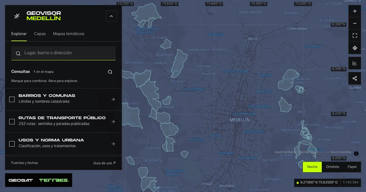
What it includes
- Water-supply catchments · 2014 land-use plan
27 map features · 2014-12-17 · CC BY-SA 4.0
Distrito Especial de Ciencia Tecnología e Innovación de Medellín - GeoMedellín - Dato proporcionado por Departamento Administrativo de Planeación - Subdirección de Planeación Territorial y Estratégica de Ciudad · Adaptación GeoSAT: selección de atributos y fechas ISO; conversión WGS84 del servidor original, sin redondeo ni simplificación de geometrías · Source checked: 2026-09-28
27 rural water-supply catchments and subcatchments published for the 2014 land-use plan at 1:5,000 scale. Every record has adoption and update dates of December 17, 2014; the metadata was published and revised on March 19, 2015. Every component, hole and WGS84 coordinate returned by the server is preserved. Five records do not name an aqueduct and two do not name a rural district. These areas relate to reserves and aqueducts in other layers: their areas should not be added as independent coverage. They do not describe flow, water quality or current water-supply operation. For regulatory decisions consult the adopted map of Agreement 48 of 2014.
Official source ↗
How to use it
- Click “Open this query” to load Water-supply catchments · 2014 land-use plan in the viewer.
- Select a feature on the map or in the Results list to read its record with attributes, source and date.
- Build a thematic map to compare, or open statistics to analyze the loaded data.
- Share the view link or export received results with attribution and dates.
Follow the river and streams →
Frequently asked questions
What does “Water-supply catchments” open on the map?
27 areas · aqueducts and rural districts · 2014 plan: 1 layer (Water-supply catchments · 2014 land-use plan), with 27 published map features.
Where do the data come from, and how can they be reused?
Layers come from Distrito Especial de Ciencia Tecnología e Innovación de Medellín - GeoMedellín - Dato proporcionado por Departamento Administrativo de Planeación - Subdirección de Planeación Territorial y Estratégica de Ciudad · Adaptación GeoSAT: selección de atributos y fechas ISO; conversión WGS84 del servidor original, sin redondeo ni simplificación de geometrías. Published licenses: CC BY-SA 4.0. Each record retains its source and date; check the exact license before reuse.
Are the results complete?
This query loads 1 layer from reference publications by pages within the queried area, up to 5,000 map features and 8 MiB per layer. Wait for loading to finish before interpreting statistics; zoom in if the limit is exceeded. The queried area is not the complete municipal inventory.
Do I need an account or payment?
No. The Medellín geovisor is free with no account: open the query, explore, export received results and share the link. Last GeoSAT verification: 2026-09-28.