
Torrent-flow hazard in Medellín
115 polygons · three planning hazard degrees.
1 layer · 115 published map features · Distrito de Medellín · GeoMedellín · Departamento Administrativo de Planeación · Adaptación GeoSAT: atributos seleccionados, fechas UTC ISO, WGS84 y simplificación topológica hasta 1 m, conservando componentes y huecos, con variación de área inferior al 0,5 % por registro
Open this query ↗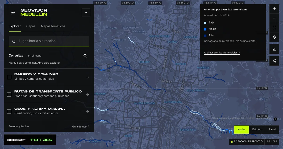
What it includes
- Torrent-flow hazard · land-use plan
115 map features · date not declared · Cartografía pública municipal · licencia específica no indicada
Distrito de Medellín · GeoMedellín · Departamento Administrativo de Planeación · Adaptación GeoSAT: atributos seleccionados, fechas UTC ISO, WGS84 y simplificación topológica hasta 1 m, conservando componentes y huecos, con variación de área inferior al 0,5 % por registro · Source checked: 2026-09-28
115 polygons: 52 low, 32 medium and 31 high hazard. Reference to the land-use plan adopted by Agreement 48 of 2014, distinct from flood hazard. All records state adoption on December 17, 2014; 64 state an April 30, 2026 update and 51 a July 17, 2026 update. These dates and published codes remain unchanged, including alternative codes for the same category. The official layer title mentions high hazard, but its data and legend include all three degrees. These are not observed events, forecasts, warnings or property safety assessments. Consult Planning and the official adopted map for authoritative decisions. The service declares no specific reuse license.
Official source ↗
How to use it
- Click “Open this query” to load Torrent-flow hazard · land-use plan in the viewer.
- Select a feature on the map or in the Results list to read its record with attributes, source and date.
- Build a thematic map to compare, or open statistics to analyze the loaded data.
- Share the view link or export received results with attribution and dates.
Distinguish hazard and risk conditions →
Frequently asked questions
What does “Torrent-flow hazard” open on the map?
115 polygons · three planning hazard degrees: 1 layer (Torrent-flow hazard · land-use plan), with 115 published map features.
Where do the data come from, and how can they be reused?
Layers come from Distrito de Medellín · GeoMedellín · Departamento Administrativo de Planeación · Adaptación GeoSAT: atributos seleccionados, fechas UTC ISO, WGS84 y simplificación topológica hasta 1 m, conservando componentes y huecos, con variación de área inferior al 0,5 % por registro. Published licenses: Cartografía pública municipal · licencia específica no indicada. Each record retains its source and date; check the exact license before reuse.
Are the results complete?
This query loads 1 layer from reference publications by pages within the queried area, up to 5,000 map features and 8 MiB per layer. Wait for loading to finish before interpreting statistics; zoom in if the limit is exceeded. The queried area is not the complete municipal inventory.
Do I need an account or payment?
No. The Medellín geovisor is free with no account: open the query, explore, export received results and share the link. Last GeoSAT verification: 2026-09-28.