
School meals in Medellín
AM/PM students per school site · 2024 records.
1 layer · 779 published records · Distrito Especial de Ciencia Tecnología e Innovación de Medellín · GeoMedellín · Adaptación GeoSAT: selección y nombres de atributos públicos; geometría WGS84 transformada por el servicio de origen sin simplificación · Secretaría de Educación
Open this query ↗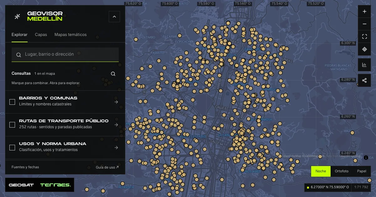
What it includes
- AM/PM school meals · 2024 records
779 records · date not declared · Inventario público municipal · licencia específica no indicada
Distrito Especial de Ciencia Tecnología e Innovación de Medellín · GeoMedellín · Adaptación GeoSAT: selección y nombres de atributos públicos; geometría WGS84 transformada por el servicio de origen sin simplificación · Secretaría de Educación · Source checked: 2026-09-28
779 school-site records for the published 2024 period. Metadata defines the measure as students receiving the AM/PM food strategy within the school. All 303 published zeros are retained; the source does not explain whether each zero means no beneficiaries or missing reporting. Other measures with undocumented abbreviations are omitted. Locations repeat the educational inventory and outcomes layer: do not sum these layers as unique sites or students. Records do not confirm places, menus, eligibility or current provision. No precise update date or specific reuse license is declared.
Official source ↗
How to use it
- Click “Open this query” to load AM/PM school meals · 2024 records in the viewer.
- Select a feature on the map or in the Results list to read its record with attributes, source and date.
- Build a thematic map to compare, or open statistics to analyze the loaded data.
- Share the view link or export received results with attribution and dates.
Frequently asked questions
What does “School meals” open on the map?
AM/PM students per school site · 2024 records: 1 layer (AM/PM school meals · 2024 records), with 779 published records.
Where do the data come from, and how can they be reused?
Layers come from Distrito Especial de Ciencia Tecnología e Innovación de Medellín · GeoMedellín · Adaptación GeoSAT: selección y nombres de atributos públicos; geometría WGS84 transformada por el servicio de origen sin simplificación · Secretaría de Educación. Published licenses: Inventario público municipal · licencia específica no indicada. Each record retains its source and date; check the exact license before reuse.
Are the results complete?
This query loads 1 layer from reference publications by pages within the queried area, up to 5,000 records and 8 MiB per layer. Wait for loading to finish before interpreting statistics; zoom in if the limit is exceeded. The queried area is not the complete municipal inventory.
Do I need an account or payment?
No. The Medellín geovisor is free with no account: open the query, explore, export received results and share the link. Last GeoSAT verification: 2026-09-28.