
Water in San Antonio de Prado in Medellín
Sites and stream setbacks · 2012–2017 historical campaigns.
2 layers · 149 published map features · Distrito de Medellín · Secretaría de Medio Ambiente · Adaptación GeoSAT: atributos seleccionados, fechas UTC en formato ISO y coordenadas WGS84 redondeadas a siete decimales, sin simplificación
Open this query ↗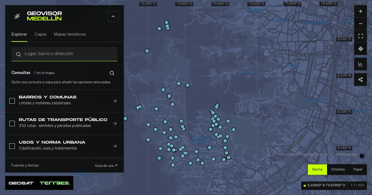
What it includes
- Sampling sites · San Antonio de Prado
75 map features · 2018-01-22 · Cartografía pública municipal · licencia específica no indicada
Distrito de Medellín · Secretaría de Medio Ambiente · Adaptación GeoSAT: atributos seleccionados, fechas UTC en formato ISO y coordenadas WGS84 redondeadas a siete decimales, sin simplificación · Source checked: 2026-09-28
75 San Antonio de Prado monitoring sites. The most recent site date in the attributes is January 22, 2018; quality categories are published for the 2013, 2015 and 2017 campaigns. Text categories, including “N/A” and “No observation”, are retained without treating zero-valued numeric indices as measurements. These records do not describe current quality or drinking safety. The service states no specific reuse license.
Official source ↗ - Stream setback quality · historical
74 map features · date not declared · Cartografía pública municipal · licencia específica no indicada
Distrito de Medellín · Secretaría de Medio Ambiente · Adaptación GeoSAT: atributos seleccionados, fechas UTC en formato ISO y coordenadas WGS84 redondeadas a siete decimales, sin simplificación · Source checked: 2026-09-28
74 polygons with published IIR categories for 2012, 2013, 2015 and 2017, plus five pressure fields. “N/A”, “No information” and spelling variants remain as published. Pressures describe a historical assessment, not currently verified conditions or a current legal setback boundary. Geometry retains components and holes without simplification. The service states no specific reuse license.
Official source ↗
How to use it
- Click “Open this query” to load Sampling sites · San Antonio de Prado and Stream setback quality · historical in the viewer.
- Select a feature on the map or in the Results list to read its record with attributes, source and date.
- Build a thematic map to compare, or open statistics to analyze the loaded data.
- Share the view link or export received results with attribution and dates.
Frequently asked questions
What does “Water in San Antonio de Prado” open on the map?
Sites and stream setbacks · 2012–2017 historical campaigns: 2 layers (Sampling sites · San Antonio de Prado and Stream setback quality · historical), with 149 published map features.
Where do the data come from, and how can they be reused?
Layers come from Distrito de Medellín · Secretaría de Medio Ambiente · Adaptación GeoSAT: atributos seleccionados, fechas UTC en formato ISO y coordenadas WGS84 redondeadas a siete decimales, sin simplificación. Published licenses: Cartografía pública municipal · licencia específica no indicada. Each record retains its source and date; check the exact license before reuse.
Are the results complete?
This query loads 2 layers from reference publications by pages within the queried area, up to 5,000 map features and 8 MiB per layer. Wait for loading to finish before interpreting statistics; zoom in if the limit is exceeded. The queried area is not the complete municipal inventory.
Do I need an account or payment?
No. The Medellín geovisor is free with no account: open the query, explore, export received results and share the link. Last GeoSAT verification: 2026-09-28.