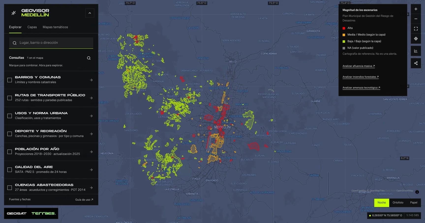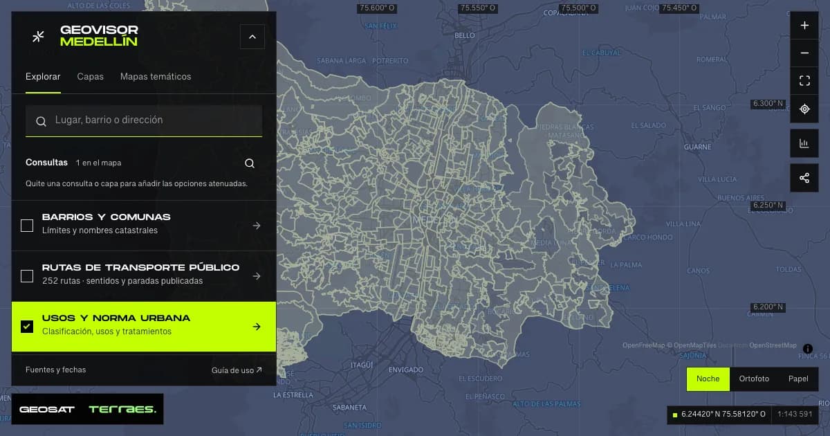
Medellín’s POT is its land-use plan. GeoSAT lets you identify a parcel, inspect 24 urban and rural topics, read municipal tables and documents, compare two properties and prepare a brief with its map and sources. It runs in your browser, free and without an account.
Open GeoSAT’s POT consultation. Enter the viewer and choose Property. This guide describes the workflow published on October 5, 2026. GeoSAT is an independent viewer that queries public sources; it is not the City government’s official platform.
First consultation: find, confirm and read
- In Property, choose Search by: address, CBML or property registry number. You can also Select on map.
- Inspect the result and outline before confirming the parcel. An approximate address may return several candidates.
- Open Topics and results and select Classification. Then review uses, treatment, development parameters and restrictions.
- Switching topics retains the parcel and updates the map, legend and results together.
- Review Source query status, notices and documents. Copy the link and use Print brief once the map has loaded.
To practice without a private address, search for City Hall at Calle 44 # 52-165, or its public CBML 10100030004. Verify the outline even in this example. Results are queried again and can change with the source.
1. Search by address, registry number, CBML or map
| Method | What to enter or do | What to verify |
|---|---|---|
| Address | Use street nomenclature such as Calle 44 # 52-165. Choose a candidate if a list appears. | The address and parcel must match the intended place. |
| Property registry number | Enter the numeric folio. If you include an office prefix such as 001-, the source queries the numeric folio. | The service does not verify the registry office. Confirm the address and outline; this is not a title certificate. |
| CBML | Enter all 11 digits without spaces or separators. Keep leading zeros. | Use the municipal parcel code, not another cadastral identifier. |
| Map selection | Activate the button and click inside the parcel. Cancel selection to return to navigation. | Inspect the returned outline, particularly near roads or boundaries. |
CBML means Comuna, Barrio, Manzana and Lote: district, neighborhood, block and parcel. It identifies a cadastral parcel that may contain several buildings or units. It is not an apartment’s registry number. A search may locate the parcel without identifying a private unit within it.
Use the search inside Property for this workflow. The general place search in Explore helps you navigate and does not replace municipal cadastral identification.
2. Confirm the parcel and understand its areas
Recognize nearby streets, buildings and boundaries before continuing. If this is the wrong parcel, search again rather than interpreting its results as conditions on your property.
The brief distinguishes geometric area, calculated from the received polygon, from attribute area, published by the source. Editions, precision and methods can differ. Neither alone replaces the area on a deed or a land survey. GeoSAT calculates intersections over the complete parcel using the metric EPSG:9377 coordinate system.
The selection outline identifies the parcel. Its color is not a land-use or treatment category; read the active topic’s legend for that information.
3. Explore all 24 POT topics
Use the topic selector and the urban/rural scope filter. For a mixed parcel, keep All and inspect both scopes. The filter organizes the consultation; it does not determine the parcel’s land classification.
| Available topics | What to inspect |
|---|---|
| Classification | Urban, rural or expansion land, including each part of a parcel crossing classes. |
| Urban use; Rural use | General categories and subcategories. These alone do not authorize a specific activity. |
| Treatment; Rural treatment | Planning actions and the relevant planning-polygon codes. |
| Development parameters; Rural development parameters | Published density, floor-area ratio, height, site coverage or other parameters, with units and conditions. |
| Urban roads; Rural roads; Road projects | Hierarchies, reserves and projects. A proposed line does not establish completed construction. |
| Heritage; Complementary planning instruments | Heritage categories and instruments requiring their associated documents and administrative acts. |
| Public dedications; Proposed public space | Published obligations and proposals. A polygon does not establish delivery or construction. |
| Parking requirements; Building form and habitability; Rural habitability | Tables and documents, including minimum dwelling and parcel requirements when provided. |
| River and stream setbacks; Ecological structure; Protected land | Environmental and territorial conditions to read alongside other restrictions. |
| Risk conditions; Flood hazard; Landslide hazard; Torrent-flow hazard | Distinct risk and hazard topics. These are not stability assessments or real-time alerts. |
Ten topics provide calculated geometric intersections: classification, both uses, treatment, urban development parameters, risk, protection and the three hazards. The other fourteen present municipal queries and context maps. A context map shows surrounding symbols; it does not turn those symbols into calculated affected areas.
4. Read results, legends and percentages
Select a topic and check that the legend title matches the map. Open Published values to inspect attributes. When an area-intersection card is available, select it to highlight its geometry.
A 25% result means a polygon from that source covers one quarter of the parcel’s geometric area. It does not mean a 25% chance of flooding or 25% development capacity. Boundary contact can occur without shared area. Do not add percentages from overlapping polygons.
The municipal table and calculated intersections are separate because they may use different data editions. Preserve that distinction when percentages differ; do not combine them to reach 100%.
For development parameters, distinguish density in dwellings per hectare, floor-area ratio in floor m² per land m², and numeric height in floors. Check the net or gross calculation basis and retain values such as “Variable” and “N/A”. Multiplying a parameter by cadastral area does not automatically establish permitted development capacity.
5. Check sources, notices and municipal documents
In Source query status, read each topic’s status:
| Status | Meaning |
|---|---|
| Pending or querying | Wait before documenting the result. |
| Area overlap | A polygon from this source shares area with the parcel. |
| Boundary contact | Geometries touch without sharing area. |
| No intersections | The source responded without matches; other layers may contain conditions. |
| Municipal query | Read the table, documents and context-map scope. |
| Partial response | One part responded while another, such as the table or mapping, was unavailable. |
| Unavailable | The query failed. This cannot establish that the parcel has no applicable conditions. |
The counter measures responding topics, not completion of a full planning review. Source, dates and method preserves provenance. The retrieval date indicates when the response was obtained; it does not establish the data’s update date or legal validity.
Read Parcel notices and updates before opening documents. GeoSAT displays received notices and respects report restrictions returned by the source. It does not necessarily collect every administrative act affecting a property.
When the source provides them, documents cover PAU and use categories, development parameters, site coverage, public dedications, parking, rural activities, rural height, rural density, rural site coverage, rural habitability, minimum dwelling size, and minimum parcel area/frontage. PAU refers to the Environmental and Urban Planning Protocol; read its category and requirements without assuming automatic compliance.
These PDFs are generated by the municipal service. They may open in another tab; allow that opening if your browser blocks it. An empty or failed PDF does not establish absence of conditions. During the October 5 verification, a rural habitability table failed while its independent PDF worked, and one dedication report returned a blank document. Retry or consult the source directly and retain unresolved items.
6. Compare two properties
- Confirm the first parcel and choose Compare another.
- Find the second parcel using any supported method and confirm its outline.
- Choose the same topic for both results. Check sources, units and status in each column.
- Change the active parcel to inspect it on the map. Remove one to return to a single-property inquiry.
This comparison helps prepare questions about two alternatives. It does not rank investments or establish development feasibility. Compare the same parameter and method, keeping missing information visible.
7. Consult Acuerdo 48 and the 2026 proposal
Open Acuerdo 48 ↔ 2026 proposal and request the comparison. This query loads separately. The main map and tables continue to use Acuerdo 48 sources; loading the proposal does not turn the main map into newly adopted rules.
Inspect each section, its source and coverage. The service can use fallback sources or return errors: a received value does not necessarily come from a new 2026 edition. The proposal is presented separately from adopted rules.
The City also provides this comparison in Consulta Normativa. Its August 25, 2026 announcement describes the review as a proposal and introduces a document consultation lab. Comparison is not exclusive to GeoSAT. Check the District POT Record for later versions.
8. Share and print a verifiable brief
Copy link retains parcels through their CBML references, the topic and the view. It does not include the registry number entered. The link does identify the parcels, so share it with people who need the inquiry. Opening it queries the sources again; it is not a frozen result.
To preserve evidence:
- Wait for the queries and map to load. Note pending or failed sources.
- Choose the topic you want to show and frame the parcel.
- Select Print brief, then save as PDF in the browser.
- Check the active map, legend, CBMLs, dates, tables, notices and statuses. The proposal is included if it was loaded.
- If “Map not captured” appears, wait and print again. The brief contains the active map, not a separate map image for every topic.
The GeoSAT brief and municipal PDFs are different documents. Keep both when needed, along with source links. A standalone screenshot loses that traceability.
9. Use help, the keyboard and your phone
Help buttons explain POT, CBML, areas, topics and statuses. Hover, focus with Tab or tap; Escape closes help. Use result lists when a polygon is too small to select easily.
On your phone, collapse the panel to navigate and reopen it to read. Go to topics and results skips the beginning of the brief. Wide tables can scroll horizontally. When changing languages, use the language links to find this guide’s corresponding version.
Analyze CIIU activities for a parcel
With the parcel confirmed, go to Can I carry out this activity? and select Search CIIU activities. The municipality determines the available urban or rural scope. Search a code such as 5611 or a word such as restaurante; source activity names are in Spanish.
- Select up to three activities. One code can appear in several descriptions: read the name and scope before choosing.
- Mark each activity as New or Existing. This is an input declaration, not evidence of age or acquired rights.
- Select Analyze activities. Review each activity, size or capacity band, determination and environmental or planning PAU condition separately.
- If Further municipal review required appears, follow Municipal Land Use: determination and applications. Do not interpret a conditional response or referral to Mercurio as approval.
Results include parcel, activities, source and retrieval date. Values follow the municipal publication; retain their scopes and do not add percentages across different tables. Loaded analysis appears in the printed brief. Activities are excluded from shared links. Changing parcels or refreshing sources requires another query. Source failure establishes neither feasibility nor prohibition.
Add municipal maps and imagery
Open Layers → Add layers → More municipal maps and imagery → Browse public directory. Choose a folder and search within it: ordenamiento_ter contains planning services; ServiciosImagen contains orthophotos and historical imagery.
Select a service, read its description and, for maps, choose the layers to display. Select Add to map. Keep up to four services and adjust opacity, bring forward or remove each under Added municipal maps. Expand Legend and source for published symbols, metadata and retrieval time. Imagery does not necessarily have categorical legends.
These are context overlays, not automatic parcel intersections or statistical inputs. They are hidden when you return to Property to keep parcel results distinct, and reappear when exploring. They persist during the page session, but not after reload or in shared links. Imagery may cover only part of the city, depend on scale or be temporarily unavailable. A year in a name does not establish currency, and public access does not itself grant redistribution rights.
The Image bank link opens municipal queries and requests. Services requiring accounts or tokens remain in the official portal. GeoSAT does not request municipal credentials.
Capture coordinates and look up batches of addresses
Open Layers → Tools: coordinates, addresses and measurement. Capture and project coordinates lets you pick a map point, use its center with a keyboard or enter X/Y. Choose the input system and use decimal points: X is longitude or easting; Y is latitude or northing. The municipal projection returns WGS84 (EPSG:4326), MAGNA Medellín (6257), MAGNA Colombia Bogotá (3116) and Origen Nacional (9377). Locate the result or download CSV. This is limited to the Medellín area, does not convert heights and does not replace a survey.
Under Look up a batch of addresses, paste one address per line, up to 1,000, with at most 80 characters per address. Submitting sends addresses through GeoSAT to the municipal service, without analytics. This uses cadastral street addresses; it does not promise the road-network or place-name precision levels of the municipal geocoder.
Review candidates and select one per address before mapping or downloading GeoJSON. Unmatched, failed and pending rows remain explicit; download all rows and statuses as JSON. Each point represents published address nomenclature, not a certified parcel centroid. Stop and keep results interrupts processing. Download before leaving Tools or reloading: the form is not saved. Mapped selections remain under Layers → My files, subject to the existing limit of three local files.
For Excel files, precision levels and account operations, use Municipal geocoder. MapGIS links also retain access to external WMS/REST services, accounts and geoprocessing. GeoSAT does not submit applications or send emails on the user’s behalf.
GeoSAT compared with MapGIS, screenshots and desktop GIS
We cover the core parcel search and inquiry workflow of Consulta POT; we do not claim every MapGIS feature. The municipal 2024 Consulta POT manual already documents four search methods, urban/rural scopes, topic legends, notices and reports. These are shared capabilities.
| Need | What GeoSAT contributes | What other methods still provide |
|---|---|---|
| Identify a parcel and change topics | Confirmed outline, retained selection, and coordinated map, results and legend. | Municipal records and mapping remain reference sources. |
| Understand the inquiry | Help beside controls, explicit statuses, and separated tables and intersections. | Professional interpretation of conditions and administrative acts remains relevant to the decision. |
| Compare two alternatives | Two parcels in one brief under the same topic. | Verify compatible sources, dates and calculation bases. |
| Present results | A link that queries again and a brief with map, legend, sources and unresolved items. | A saved PDF preserves that inquiry; the link can change. |
| Review the 2026 proposal | Access from the parcel brief and visible source coverage. | Consulta Normativa and the official document lab complement the research. |
| Analyze a CIIU business activity | Up to three activities per parcel, new/existing status, capacity bands and conditions returned by the municipality. | Formal determinations and applications remain in municipal Land Use; a query is not authorization. |
| Expand maps and tools | Municipal directory, imagery, legends, coordinate projection and batch address lookup. | MapGIS retains accounts, geoprocessing, Excel geocoding and external WMS/REST services. |
| Perform specialist GIS work | Parcel inquiry without preparing a desktop project. | QGIS or another GIS supports custom analysis, data editing and models outside this brief’s scope. |
Compared with a collection of screenshots, the practical improvement is keeping parcel identity, topic and provenance in one workflow. Compared with manually preparing intersections in a desktop GIS, GeoSAT provides a ready-to-use parcel inquiry. These are observable workflow benefits, not measured speed gains or claims that our data is more official or complete.
GeoSAT queries the service behind the municipal land-use tool. Authority and applications remain with the municipality. We do not reproduce every MapGIS feature or guarantee availability of every source.
If something goes wrong
| Problem | What to do |
|---|---|
| Registry number is not found | Check the folio and try CBML, address or map selection. The office prefix is not verified. |
| Several parcels appear | Compare addresses and outlines before confirming; do not choose by list position alone. |
| A topic has no color or data | Read its status: a failed source and a successful query without intersections are different cases. |
| The table and map differ | Keep both with their sources. Editions or methods can differ. |
| A report fails to open or is blank | Check tab blocking, retry and consult the municipal service. An empty report is not an exemption. |
| A shared link returns different values | It queries current sources. Compare against the saved PDF and dates. |
| You need to know whether you can build or open a business | Gather CBML, sources, results and unresolved items to check the activity and instruments with the competent authority or professional. |
A useful inquiry ends with a confirmed parcel, identified results, reviewed documents and explicit unresolved questions. It does not issue licenses, certificates, official opinions, development rights or safety assessments.
Continue with the general viewer guide, POT mapping sources, Terraes’s Spanish guide to land use before buying property, or GeoSAT’s GIS services for spatial planning and POT.